Northern Germany
Numéro d’image : 11736091
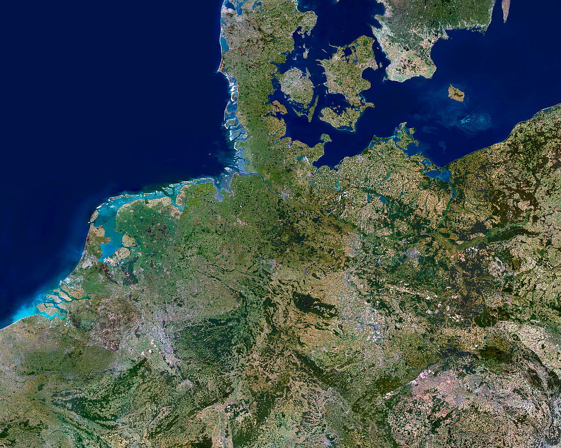
| Northern Germany. Satellite image of northern Europe,centred on northern Germany. North is at top. Green colours show different vegetation,from fields to forests. Grey colours show urban areas. Lighter blue colours show shallow coastal areas and river sediments. The area shown ranges from the Netherlands (centre left) and Belgium (lower left) to part of Poland (far right). Most of the land between is northern and central Germany,with most of Denmark and part of Sweden at top. Part of the North Sea is at top left,and part of the Baltic Sea is at top right. The area seen is about 1000 kilometres across. Data acquired by a Landsat satellite | |
| Licence : | Droits gérés |
| Crédit: | Science Photo Library / Planetobserver |
| Taille de l’image : | 5906 px × 4724 px |
| Model Release : | Non requis |
| Property Release : | Non requis |
| Restrictions : | - |
Prix pour cette image À partir de 45 €
Produit vendu
(Calendrier, Carte postale, Carte de vœux, Impression sur textile, Packaging etc)
À partir de 45 €
Usage commercial
(Affichage, Annonce presse, Annonce TV, Carte, Digital - hors rés. sociaux, Digital - rés. sociaux etc)
À partir de 45 €
Éditorial
(Digital, Journal, Livre, Livre pratique, Magazine, Télévision etc)
À partir de 60 €
Usage non-commercial
(Digital - hors rés. sociaux, Digital - rés. sociaux etc)
À partir de 120 €
Mots clés
- Allemagne,
- Atlantique,
- baltique,
- Belgique,
- côte,
- côtier,
- couverture des terres,
- couverture terrestre,
- Danemark,
- de l'espace,
- du nord,
- eau,
- état,
- Europe,
- européen,
- géographie,
- géographique,
- image satellite,
- Landsat,
- littoral,
- mer,
- nation,
- nations,
- nord,
- observation de la terre,
- océan,
- pays,
- Pays-Bas,
- satellite,
- science de la terre,
- sciences,
- spetentrional,
- terre,
- utilisation des terres