Lake Titicaca
Numéro d’image : 12631795
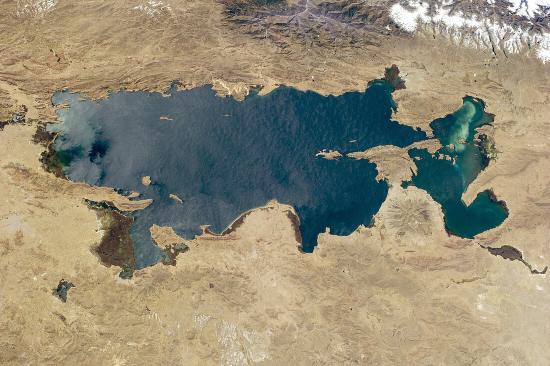
| As the International Space Station flew over the Atacama Desert of coastal Peru, an astronaut looked to the north and captured the entire 190-kilometer (120-mile) length of Lake Titicaca. The lake lies on the high Andes plateau, along the border between Peru and Bolivia. It is the highest major body of navigable water in the world (3, 800 meters or 12, 500 feet in elevation) and the largest lake in South America. Lake Titicaca is one of the most popular tourist attractions in South America. Many rivers drain into the lake, including several draining glaciers (top right). A semicircular river delta bulges into the lake (center), while some other rivers enter through protected bays and make dark green wetlands. A green algal bloom appears at the south end of the lake (right). (North is to the top left of the image.) | |
| Licence : | Droits gérés |
| Crédit: | Science Photo Library / NASA / JPL |
| Taille de l’image : | 4256 px × 2832 px |
| Model Release : | Non requis |
| Property Release : | Non requis |
| Restrictions : | - |
Prix pour cette image À partir de 45 €
Produit vendu
(Calendrier, Carte postale, Carte de vœux, Impression sur textile, Packaging etc)
À partir de 45 €
Usage commercial
(Affichage, Annonce presse, Annonce TV, Carte, Digital - hors rés. sociaux, Digital - rés. sociaux etc)
À partir de 45 €
Éditorial
(Digital, Journal, Livre, Livre pratique, Magazine, Télévision etc)
À partir de 60 €
Usage non-commercial
(Digital - hors rés. sociaux, Digital - rés. sociaux etc)
À partir de 120 €
Mots clés
- aérien,
- algae,
- algues,
- Amérique du Sud,
- baie,
- Bolivie,
- d'en haut,
- delta,
- désert d'Atacama,
- du haut,
- eau,
- efflorescence algale,
- géographie,
- géographique,
- image satellite,
- lac,
- Lakeshore,
- observation de la terre,
- paysage,
- Pérou,
- plongeant,
- rivage,
- rivière,
- science,
- terre humide,
- terre vue de l'espace,
- topographie,
- topographique,
- zone humide