Zaatari Refugee Camp, Jordan, satellite image
Numéro d’image : 12540278
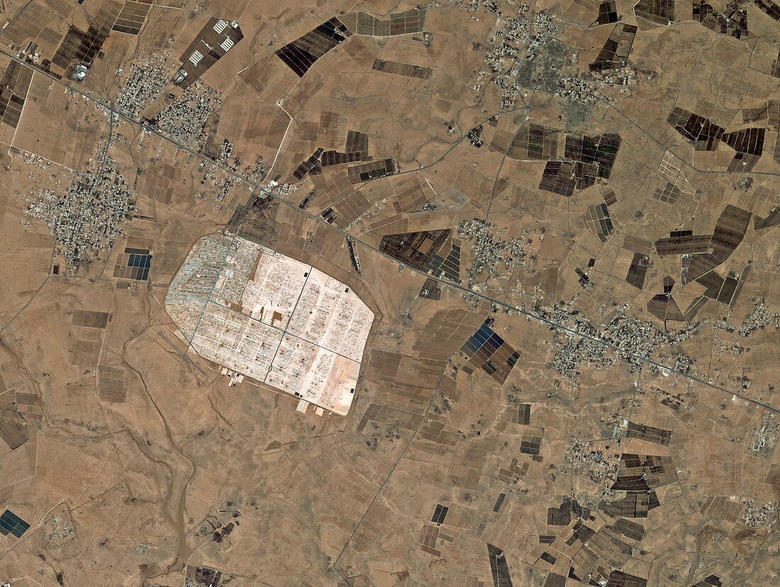
| Zaatari Refugee Camp, Jordan, satellite image. This image shows an area 13 kilometres east of the city of Mafraq in northern Jordan, between the Syrian Desert and volcanic Hauran plateau. Located just over 10 kilometres from the border with Syria, the camp was at this time home to over 100 000 people displaced by the conflict in the neighbouring country. Image acquired on 5 June 2013 by the Korean Kompsat-2 satellite. | |
| Licence : | Droits gérés |
| Crédit: | Science Photo Library / KARI / ESA |
| Taille de l’image : | 2823 px × 2125 px |
| Model Release : | Non requis |
| Property Release : | Non requis |
| Restrictions : |
|
Prix pour cette image À partir de 45 €
Produit vendu
(Calendrier, Carte postale, Carte de vœux, Impression sur textile, Packaging etc)
À partir de 45 €
Usage commercial
(Affichage, Annonce presse, Annonce TV, Carte, Digital - hors rés. sociaux, Digital - rés. sociaux etc)
À partir de 45 €
Éditorial
(Digital, Journal, Livre, Livre pratique, Magazine, Télévision etc)
À partir de 60 €
Usage non-commercial
(Digital - hors rés. sociaux, Digital - rés. sociaux etc)
À partir de 120 €
Mots clés
- 2000,
- 2010,
- 2013,
- 21ème siècle,
- agricole,
- agriculture,
- camp,
- camp de refugiés,
- champ,
- champs,
- conflit,
- Corée,
- coréen,
- de l'espace,
- déplacé,
- désert,
- guerre,
- humanitaire,
- image satellite,
- Jordanie,
- juin,
- Moyen Orient,
- Moyen-Orient,
- observation de la terre,
- route,
- Syrie,
- utilisation des terres,
- ville,
- villes,
- XX1ème siècle