Darfur, Sudan, satellite image
Numéro d’image : 12540234
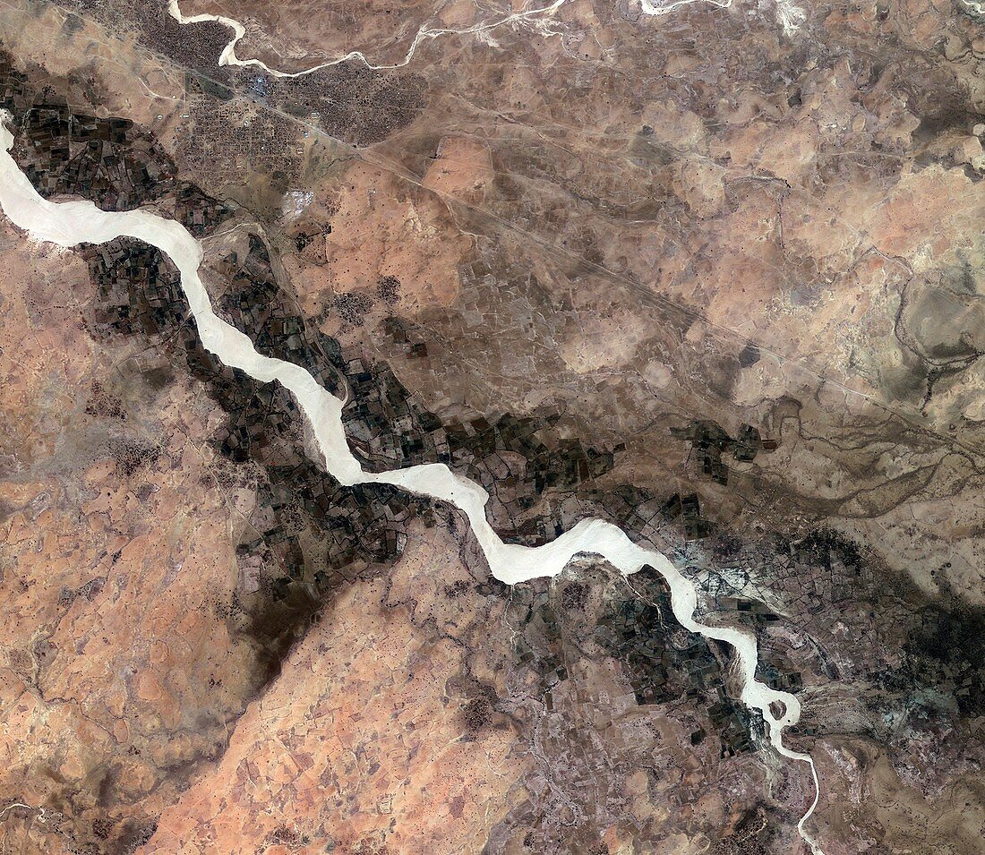
| Darfur, Sudan, satellite image. This image shows an area in the southern Darfur region of Sudan, just south of the city of Nyala. The Wadi Nyala flows diagonally across the image, surrounded by agricultural plots. To the north is the straight line of the railway. In the upper-left section are the numerous small structures of the Kalma camp, housing thousands of internally displaced people fleeing the conflict between Sudanese government forces and the indigenous population. Image acquired by Korea's Kompsat-2 satellite on 8 February 2013. | |
| Licence : | Droits gérés |
| Crédit: | Science Photo Library / KARI / ESA |
| Taille de l’image : | 2941 px × 2552 px |
| Model Release : | Non requis |
| Property Release : | Non requis |
| Restrictions : |
|
Prix pour cette image À partir de 45 €
Produit vendu
(Calendrier, Carte postale, Carte de vœux, Impression sur textile, Packaging etc)
À partir de 45 €
Usage commercial
(Affichage, Annonce presse, Annonce TV, Carte, Digital - hors rés. sociaux, Digital - rés. sociaux etc)
À partir de 45 €
Éditorial
(Digital, Journal, Livre, Livre pratique, Magazine, Télévision etc)
À partir de 60 €
Usage non-commercial
(Digital - hors rés. sociaux, Digital - rés. sociaux etc)
À partir de 120 €
Mots clés
- 2000,
- 2010,
- 2013,
- 21ème siècle,
- africain,
- Afrique,
- agricole,
- agriculture,
- austral,
- camp de refugiés,
- chemin de fer,
- conflit,
- Corée,
- coréen,
- DARFOUR,
- de l'espace,
- déplacé,
- du sud,
- février,
- guerre,
- humanitaire,
- image satellite,
- observation de la terre,
- Soudan,
- soudanais,
- utilisation des terres,
- XX1ème siècle