Milton Keynes region
Numéro d’image : 11748898
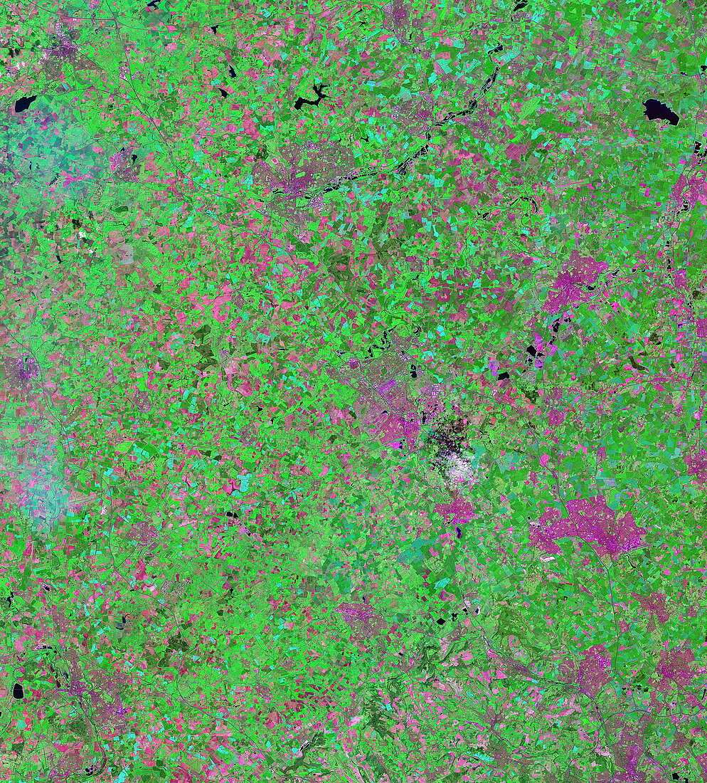
| Milton Keynes region. Satellite image of the city of Milton Keynes,UK,and the surrounding area North is at top. Urban areas are pink,and fields are either red or green depending on vegetation type and cover,while water is black. Milton Keynes is the pink area just to right of centre. A cloud and shadow is just below and at right of Milton Keynes. Further down and right is the city of Luton. The city of Oxford is in the bottom left corner,while Northampton is at upper centre,just below a lake. The large lake at upper right is Grafham Water. The area seen is some 80 kilometres from top to bottom. The image combines visible and infrared light. Taken by the Landsat 7 satellite,which launched in 1999 | |
| Licence : | Droits gérés |
| Crédit: | Science Photo Library / NASA |
| Taille de l’image : | 5385 px × 5960 px |
| Model Release : | Non requis |
| Property Release : | Non requis |
| Restrictions : | - |
Prix pour cette image À partir de 45 €
Produit vendu
(Calendrier, Carte postale, Carte de vœux, Impression sur textile, Packaging etc)
À partir de 45 €
Usage commercial
(Affichage, Annonce presse, Annonce TV, Carte, Digital - hors rés. sociaux, Digital - rés. sociaux etc)
À partir de 45 €
Éditorial
(Digital, Journal, Livre, Livre pratique, Magazine, Télévision etc)
À partir de 60 €
Usage non-commercial
(Digital - hors rés. sociaux, Digital - rés. sociaux etc)
À partir de 120 €
Mots clés
- 21ème siècle,
- agricole,
- anglais,
- Angleterre,
- britannique,
- Buckinghamshire,
- campagne,
- champ,
- champs,
- comté,
- couverture des terres,
- couverture terrestre,
- de l'espace,
- eau,
- Europe,
- européen,
- géographie,
- géographique,
- Grande-Bretagne,
- image satellite,
- infrarouge,
- IR,
- lac,
- lacs,
- landsat 7,
- LUTON,
- Northhamptonshire,
- observation de la terre,
- Oxford,
- Royaume Uni,
- Royaume-Uni,
- satellite,
- urbain,
- végétation,
- ville,
- villes,
- XX1ème siècle