River Nile,Egypt
Numéro d’image : 11744900
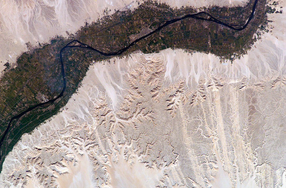
| River Nile,Egypt,seen from the International Space Station (ISS). North is towards bottom left. Agricultural fields (green) are sustained by the waters of the Nile (dark blue) as it flows right to left through the desert (brown). The Nile has eroded into the desert,leaving a plateau (up to 500 metres high) and the many water-eroded valleys seen here. Irrigation has enabled the farmed area to expand (top right) from the narrow floodplain onto the plateau slopes. This 60-kilometre-long stretch of the river flows past the city of Luxor (grey,upper centre) and its Ancient Egyptian ruins. The ISS orbits around 380 kilometres above the Earth. Photographed on 14 February 2003 | |
| Licence : | Droits gérés |
| Crédit: | Science Photo Library / NASA |
| Taille de l’image : | 3032 px × 1998 px |
| Model Release : | Non requis |
| Property Release : | Non requis |
| Restrictions : | - |
Prix pour cette image À partir de 45 €
Produit vendu
(Calendrier, Carte postale, Carte de vœux, Impression sur textile, Packaging etc)
À partir de 45 €
Usage commercial
(Affichage, Annonce presse, Annonce TV, Carte, Digital - hors rés. sociaux, Digital - rés. sociaux etc)
À partir de 45 €
Éditorial
(Digital, Journal, Livre, Livre pratique, Magazine, Télévision etc)
À partir de 60 €
Usage non-commercial
(Digital - hors rés. sociaux, Digital - rés. sociaux etc)
À partir de 120 €
Mots clés
- 2003,
- 6,
- africain,
- Afrique,
- agricole,
- agriculture,
- champ,
- champs,
- cultivé,
- de,
- désert,
- eau,
- Égypte,
- égyptien,
- égyptienne,
- environnement,
- érodé,
- érosion,
- ferme,
- fermes,
- février,
- géographie,
- irrigation,
- irrigué,
- ISS,
- le Nil,
- Louxor,
- Nil,
- observation de la terre,
- photo,
- photographie,
- plaine inondable,
- rivière,
- satellite,
- station spatiale internationale,
- terre,
- utilisation des terres,
- vallée,
- vallées