Cape Town Region,South Africa
Numéro d’image : 11736072
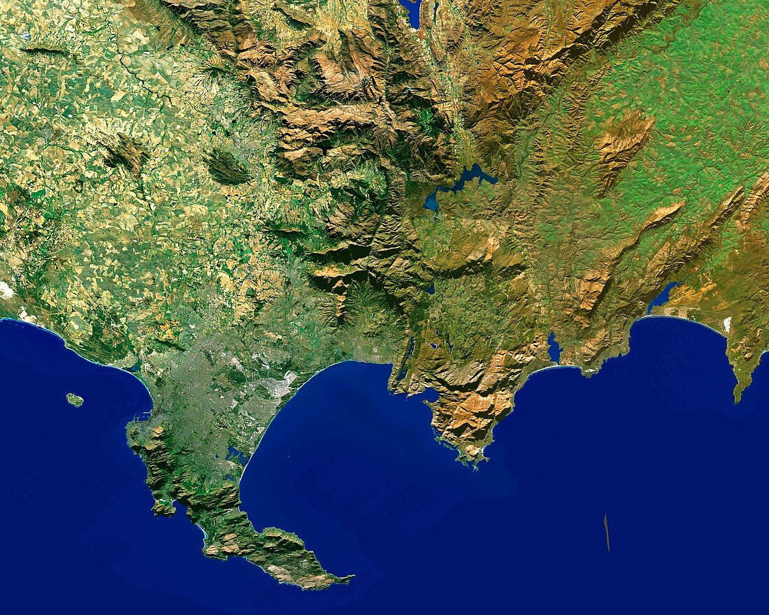
| Cape Town Region,South Africa,satellite image. North is towards upper left. The landscape varies from fields (yellow and green,upper left) to high mountains (brown,upper centre). The Cape of Good Hope is the southernmost point of the South Peninsula (lower left). Robben Island (above and left of the peninsula) lies left of Table Bay,in which lies Cape Town. Table Mountain (light brown) lies just below Table Bay. The coastline continues southwards to Danger Point (peninsula,far right) | |
| Licence : | Droits gérés |
| Crédit: | Science Photo Library / Worldsat International |
| Taille de l’image : | 4200 px × 3360 px |
| Model Release : | Non requis |
| Property Release : | Non requis |
| Restrictions : |
|
Prix pour cette image À partir de 45 €
Produit vendu
(Calendrier, Carte postale, Carte de vœux, Impression sur textile, Packaging etc)
À partir de 45 €
Usage commercial
(Affichage, Annonce presse, Annonce TV, Carte, Digital - hors rés. sociaux, Digital - rés. sociaux etc)
À partir de 45 €
Éditorial
(Digital, Journal, Livre, Livre pratique, Magazine, Télévision etc)
À partir de 60 €
Usage non-commercial
(Digital - hors rés. sociaux, Digital - rés. sociaux etc)
À partir de 120 €
Mots clés
- africain,
- Afrique du Sud,
- Baie Table,
- Cap de Bonne Espérance,
- Cape Town,
- champ,
- champs,
- côte,
- couverture,
- couvrir,
- de l'espace,
- eau,
- état,
- évident,
- ferme,
- fermes,
- géographie,
- géographique,
- littoral,
- montagne,
- montagnes,
- nation,
- nations,
- observation de la terre,
- optique,
- pays,
- province,
- région,
- sans nuage,
- sans nuages,
- satellite,
- science de la terre,
- sciences,
- terre,
- topographie,
- topographique,
- ville,
- visible,
- vraie couleur