Earth,topographical map
Numéro d’image : 11735301
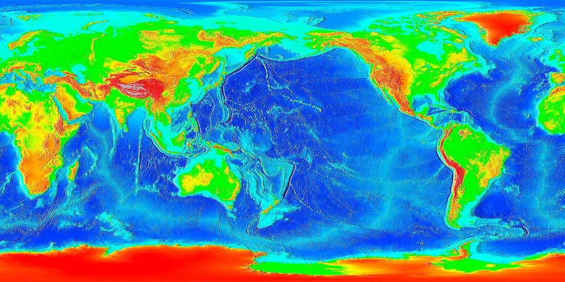
| Earth,topographical map,centred on 180 degrees East. Elevation is colour-coded. On land,low- lying areas are green,with yellow,orange,red and finally grey indicating increasing elevation. In the oceans,the shallow waters of the continental shelf are turquoise,with deeper blues showing deeper waters. The highest point on Earth is Mount Everest,at 8848 metres above sea level,in the Himalaya mountain range (grey/red,upper left). The lowest point is Challenger Deep,at 10,900 metres below sea level,at the southern end of the Mariana Trench (purple arc between Japan and New Guinea just left of centre). ***A full size version at 167Mb is available at request from SPL*** | |
| Licence : | Droits gérés |
| Crédit: | Science Photo Library / NOAA |
| Taille de l’image : | 6500 px × 3250 px |
| Model Release : | Non requis |
| Property Release : | Non requis |
| Restrictions : |
|
Prix pour cette image À partir de 45 €
Produit vendu
(Calendrier, Carte postale, Carte de vœux, Impression sur textile, Packaging etc)
À partir de 45 €
Usage commercial
(Affichage, Annonce presse, Annonce TV, Carte, Digital - hors rés. sociaux, Digital - rés. sociaux etc)
À partir de 45 €
Éditorial
(Digital, Journal, Livre, Livre pratique, Magazine, Télévision etc)
À partir de 60 €
Usage non-commercial
(Digital - hors rés. sociaux, Digital - rés. sociaux etc)
À partir de 120 €
Mots clés
- altitude,
- bathymétrie,
- carte,
- crête océanique,
- élévation,
- étagère,
- Everest,
- fond de la mer,
- fond marin,
- fond sous-marin,
- fonds marins,
- gamme,
- gammes,
- géographie,
- géographique,
- géologie,
- géologique,
- hauteur,
- Himalaya,
- images,
- mont Everest,
- montagne,
- montagnes,
- océanique,
- océanographie,
- océanographique,
- photo,
- photos,
- plages,
- plaque continental,
- science de la terre,
- sciences,
- tectonique des plaques,
- terre,
- topographie,
- topographique