Monterey bay,3-D image
Numéro d’image : 11562270
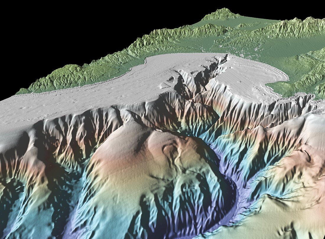
| Monterey bay. 3-D satellite and bathymetry image of Monterey bay,USA. It was produced using GeoMapApp,a geophysical visualisation program at the Lamont-Doherty Earth Observatory of Columbia University,USA,using data from the Shuttle Radar Topographic Mission (SRTM) and shipboard bathymetry measurments. The image shows seafloor topography (lower half) and land topography (upper half) | |
| Licence : | Droits gérés |
| Crédit: | Science Photo Library / GEOMAPAPP / RYAN ET AL |
| Taille de l’image : | 4000 px × 2941 px |
| Model Release : | Non requis |
| Property Release : | Non requis |
| Restrictions : | - |
Prix pour cette image À partir de 45 €
Produit vendu
(Calendrier, Carte postale, Carte de vœux, Impression sur textile, Packaging etc)
À partir de 45 €
Usage commercial
(Affichage, Annonce presse, Annonce TV, Carte, Digital - hors rés. sociaux, Digital - rés. sociaux etc)
À partir de 45 €
Éditorial
(Digital, Journal, Livre, Livre pratique, Magazine, Télévision etc)
À partir de 60 €
Usage non-commercial
(Digital - hors rés. sociaux, Digital - rés. sociaux etc)
À partir de 120 €
Mots clés
- 3 D,
- 3 dimensions,
- 3-D,
- 3D,
- américain,
- Amérique du Nord,
- baie,
- Baie de Monterey,
- bathymétrie,
- Californie,
- canyon,
- Etats-Unis,
- fond sous-marin,
- géographie,
- géographique,
- géologie,
- géologique,
- mission,
- mission de topographie radar de la navette,
- observation de la terre,
- shuttle radar topography mission,
- sous l'eau,
- sous marin,
- sous-marin,
- SRTM,
- topographie,
- trois dimensions,
- USA,
- vol spatial