Mayotte, satellite image
Numéro d’image : 14113674
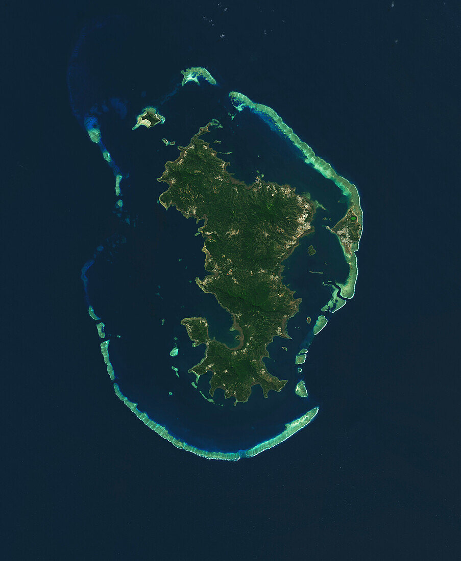
| Satellite image of the island Mayotte in the Mozambiqe Channel, Indian Ocean. Mayotte is a French territory between Madagascar and Mozambique. The capital city, Mamoudzou, spanning the north-east of Grand Terre (the main island) and Pamandzi (smaller island to the east) is visible, as are the coral reefs (light blue) which surround Mayotte, forming a lagoon. Image captured by the Operational Land Imager (OLI) on Landsat 8. | |
| Licence : | Droits gérés |
| Crédit: | Science Photo Library / NASA, Lauren Dauphin |
| Taille de l’image : | 4254 px × 5183 px |
| Model Release : | Non requis |
| Property Release : | Non requis |
| Restrictions : | - |
Prix pour cette image À partir de 45 €
Produit vendu
(Calendrier, Carte postale, Carte de vœux, Impression sur textile, Packaging etc)
À partir de 45 €
Usage commercial
(Affichage, Annonce presse, Annonce TV, Carte, Digital - hors rés. sociaux, Digital - rés. sociaux etc)
À partir de 45 €
Éditorial
(Digital, Journal, Livre, Livre pratique, Magazine, Télévision etc)
À partir de 60 €
Usage non-commercial
(Digital - hors rés. sociaux, Digital - rés. sociaux etc)
À partir de 120 €
Mots clés
- Afrique,
- aucun,
- canal du Mozambique,
- d'en haut,
- du haut,
- géographie,
- géographique,
- habité,
- huiles,
- île,
- île volcanique,
- image satellite,
- imageur terrestre opérationnel,
- lagune,
- landsat 8,
- landsat huit,
- LDCM,
- Mayotte,
- mer,
- NASA,
- observation de la terre,
- océan,
- Océan Indien,
- OLI,
- Operational Land Imager,
- personne,
- peuplé,
- plongeant,
- récifs coralliens,
- satellite,
- terre