Deforestation in Papua, Indonesia
Numéro d’image : 13417313
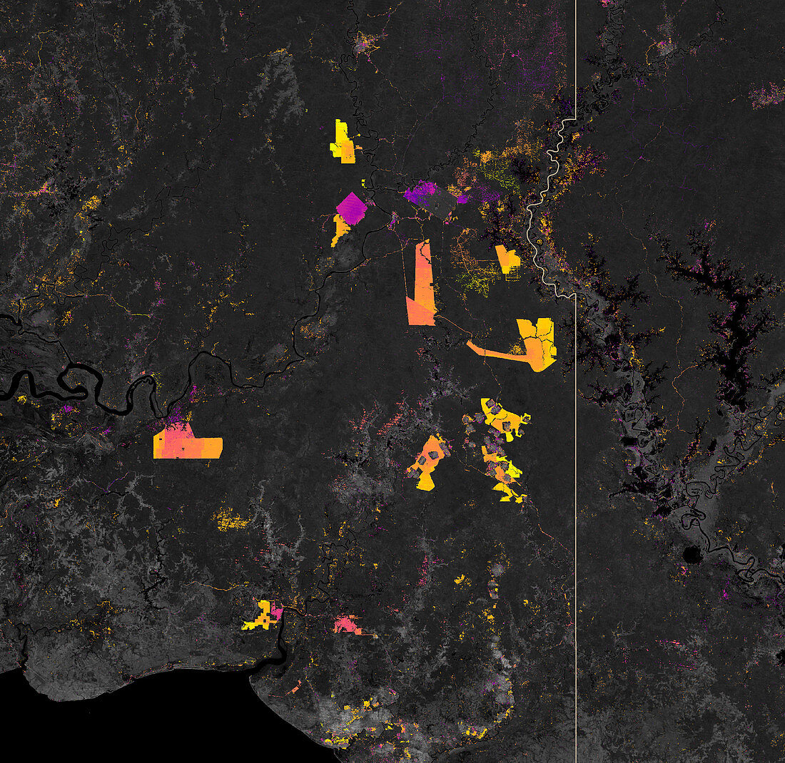
| Map showing deforestation in Papua, Indonesia using data from 2002 to 2019. Lighter coloured hotspots show more recent forest loss in comparison to purple-pink hotspots. Southern Papua has seen the deforestation of its forests for plantations. This map created using data obtained by forest change data from the University of Maryland and NASA Landsat satellite data. | |
| Licence : | Droits gérés |
| Crédit: | Science Photo Library / NASA |
| Taille de l’image : | 3000 px × 2917 px |
| Model Release : | Non requis |
| Property Release : | Non requis |
| Restrictions : | - |
Prix pour cette image À partir de 45 €
Produit vendu
(Calendrier, Carte postale, Carte de vœux, Impression sur textile, Packaging etc)
À partir de 45 €
Usage commercial
(Affichage, Annonce presse, Annonce TV, Carte, Digital - hors rés. sociaux, Digital - rés. sociaux etc)
À partir de 45 €
Éditorial
(Digital, Journal, Livre, Livre pratique, Magazine, Télévision etc)
À partir de 60 €
Usage non-commercial
(Digital - hors rés. sociaux, Digital - rés. sociaux etc)
À partir de 120 €