Deforestation in Papua, Indonesia, satellite image
Numéro d’image : 13417228
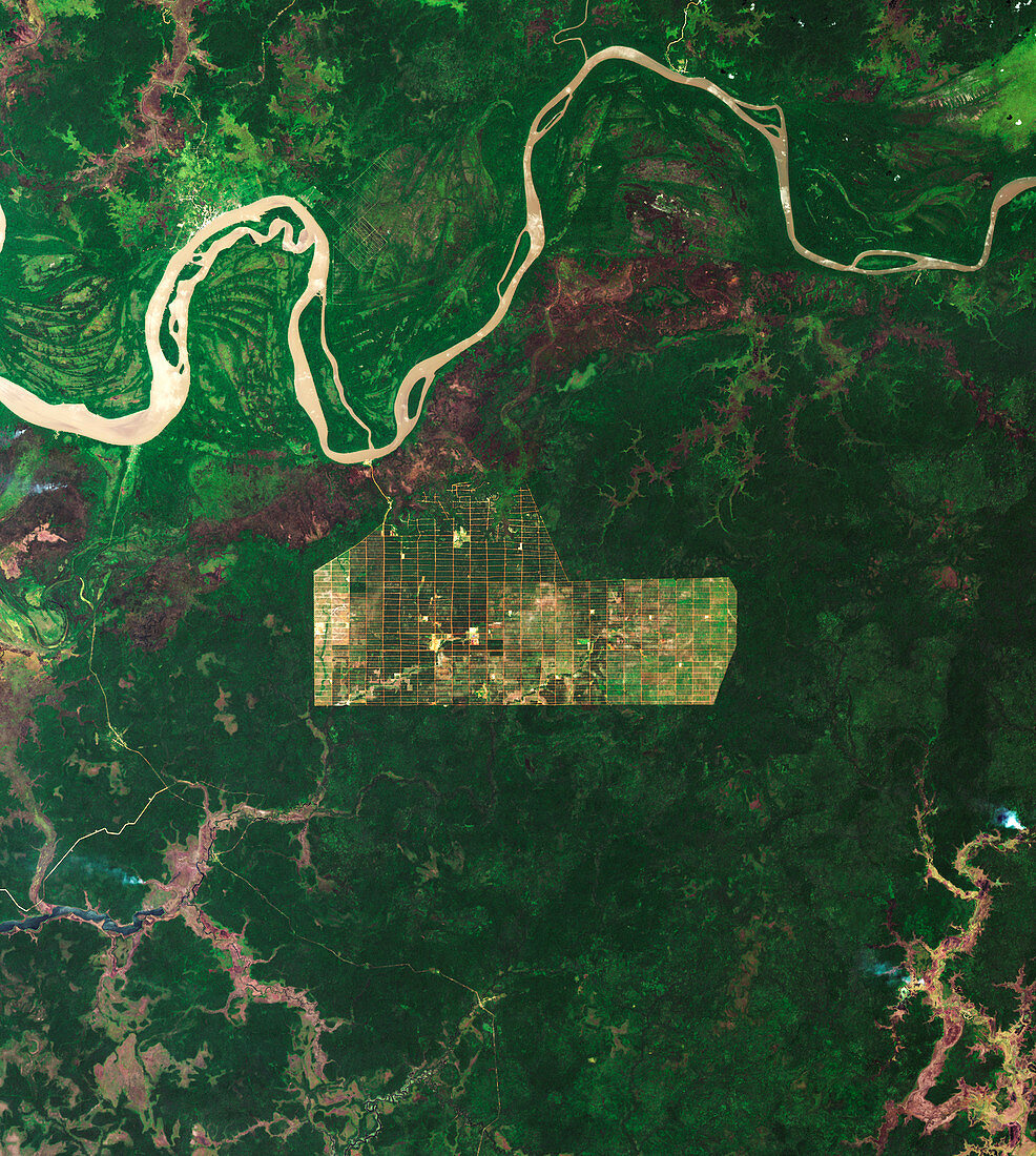
| Satellite image showing a forest clearing (centre) in Banamepe, off the Digul River, Papua, Indonesia. Image obtained using the Operational Land Imager (OLI) on the Landsat 8 satellite. | |
| Licence : | Droits gérés |
| Crédit: | Science Photo Library / NASA |
| Taille de l’image : | 2800 px × 3125 px |
| Model Release : | Non requis |
| Property Release : | Non requis |
| Restrictions : | - |
Prix pour cette image À partir de 45 €
Produit vendu
(Calendrier, Carte postale, Carte de vœux, Impression sur textile, Packaging etc)
À partir de 45 €
Usage commercial
(Affichage, Annonce presse, Annonce TV, Carte, Digital - hors rés. sociaux, Digital - rés. sociaux etc)
À partir de 45 €
Éditorial
(Digital, Journal, Livre, Livre pratique, Magazine, Télévision etc)
À partir de 60 €
Usage non-commercial
(Digital - hors rés. sociaux, Digital - rés. sociaux etc)
À partir de 120 €
Mots clés
- aucun,
- d'en haut,
- déforestation,
- du haut,
- environnement,
- environnemental,
- géographie,
- géographique,
- huiles,
- image satellite,
- imageur terrestre opérationnel,
- Indonésie,
- landsat 8,
- landsat huit,
- LDCM,
- Nouvelle Guinée occidentale,
- Nouvelle-Guinée occidentale,
- observation de la terre,
- OLI,
- Operational Land Imager,
- Papouasie,
- personne,
- plongeant