Rainforest river in Brazil, satellite image
Numéro d’image : 12950711
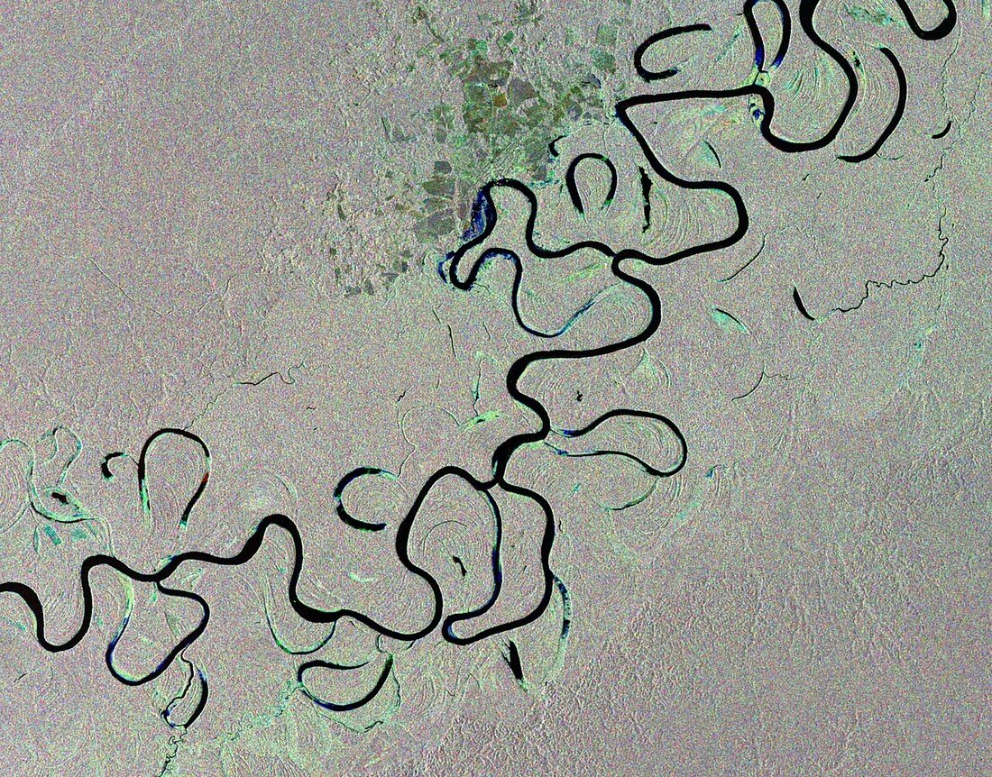
| Rainforest river in Brazil, satellite image. This river snaking through the rainforest is the Jurua River in western Brazil. One of the longest tributaries of the Amazon River, it flows slowly through the half-flooded forest as it traverses the Amazon Basin. Loops of the river are cut off as the course changes, forming classic 'oxbow lakes'. This composite combines three radar images (red, green and blue) acquired on 2 January, 1 February and 3 March 2012. Image data obtained by the European Space Agency's Envisat satellite. | |
| Licence : | Droits gérés |
| Crédit: | Science Photo Library / ESA |
| Taille de l’image : | 3685 px × 2888 px |
| Model Release : | Non requis |
| Property Release : | Non requis |
| Restrictions : |
|
Prix pour cette image À partir de 45 €
Produit vendu
(Calendrier, Carte postale, Carte de vœux, Impression sur textile, Packaging etc)
À partir de 45 €
Usage commercial
(Affichage, Annonce presse, Annonce TV, Carte, Digital - hors rés. sociaux, Digital - rés. sociaux etc)
À partir de 45 €
Éditorial
(Digital, Journal, Livre, Livre pratique, Magazine, Télévision etc)
À partir de 60 €
Usage non-commercial
(Digital - hors rés. sociaux, Digital - rés. sociaux etc)
À partir de 120 €
Mots clés
- 2012,
- 21ème siècle,
- Amazone,
- amazonien,
- Amérique du Sud,
- Amérique Latine,
- aucun,
- brésilien,
- composite,
- de l'espace,
- Envisat,
- forêt tropicale,
- forêts,
- géographie,
- géographique,
- image satellite,
- méandres,
- méandrique,
- observation de la terre,
- personne,
- rivière,
- satellite,
- séquence,
- séries,
- sinueux,
- Sud Américain,
- Sud-Américain,
- tropical,
- tropiques,
- XX1ème siècle