Rio Negro in the Amazon, LiDAR satellite image
Numéro d’image : 12950683
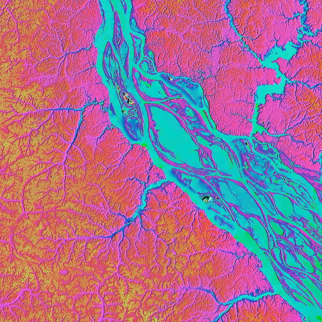
| Rio Negro in the Amazon, LiDAR satellite image. The Rio Negro is one of the largest tributary rivers of the Amazon. This area, just north-west of Manaus, the capital of the Brazilian state of Amazonas, is around 50 kilometres across. LiDAR combines optical and laser imaging to produce digital elevation maps (DEMs), with differences in elevation shown by the colour-coding of the image. Image data obtained by the radar and optical sensors on the Advanced Land Observation Satellite (ALOS) of the Japan Aerospace Exploration Agency (JAXA). | |
| Licence : | Droits gérés |
| Crédit: | Science Photo Library / JAXA / MATTHEW HURST |
| Taille de l’image : | 4180 px × 4180 px |
| Model Release : | Non requis |
| Property Release : | Non requis |
| Restrictions : | - |
Prix pour cette image À partir de 45 €
Produit vendu
(Calendrier, Carte postale, Carte de vœux, Impression sur textile, Packaging etc)
À partir de 45 €
Usage commercial
(Affichage, Annonce presse, Annonce TV, Carte, Digital - hors rés. sociaux, Digital - rés. sociaux etc)
À partir de 45 €
Éditorial
(Digital, Journal, Livre, Livre pratique, Magazine, Télévision etc)
À partir de 60 €
Usage non-commercial
(Digital - hors rés. sociaux, Digital - rés. sociaux etc)
À partir de 120 €
Mots clés
- affluent,
- Amazone,
- amazonien,
- Amérique du Sud,
- Amérique Latine,
- aucun,
- Brésil,
- carte topographique digitale,
- carte topographique numérique,
- de l'espace,
- forêt tropicale,
- géographie,
- géographique,
- image satellite,
- Jaxa,
- jungle,
- modèle altimétrique numérique,
- modèle numérique altimétrique,
- modèle numérique d'élévation,
- observation de la terre,
- personne,
- rivière,
- Sud Américain,
- Sud-Américain