Hoover Dam,Colorado River,USA
Numéro d’image : 11890438
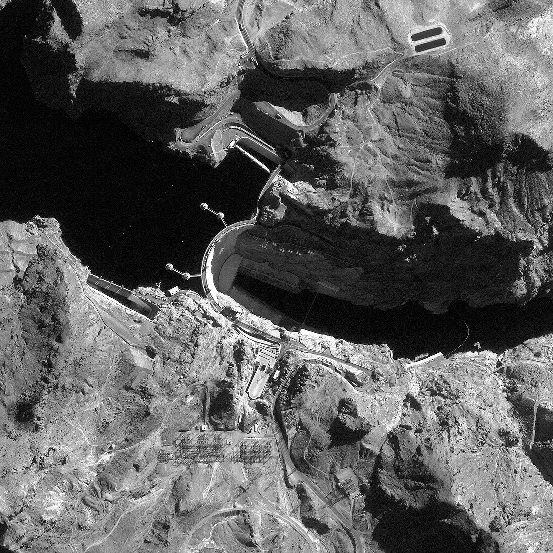
| Hoover Dam. Satellite image of the Hoover Dam (at centre) on the Colorado River,USA. The higher water level behind the dam is where Lake Mead has formed. Below the dam,the Colorado River flows through Black Canyon. The dam was built between 1931 and 1936. Hydroelectric power is generated at this dam (electricity pylons and other power station equipment seen at lower centre),providing large amount of electricity to the states of Nevada,Arizona and California. Image taken by the Ikonos satellite on 25 December 1999 | |
| Licence : | Droits gérés |
| Crédit: | Science Photo Library / Geoeye |
| Taille de l’image : | 3011 px × 3011 px |
| Model Release : | Non requis |
| Property Release : | Non requis |
| Restrictions : | - |
Prix pour cette image À partir de 45 €
Produit vendu
(Calendrier, Carte postale, Carte de vœux, Impression sur textile, Packaging etc)
À partir de 45 €
Usage commercial
(Affichage, Annonce presse, Annonce TV, Carte, Digital - hors rés. sociaux, Digital - rés. sociaux etc)
À partir de 45 €
Éditorial
(Digital, Journal, Livre, Livre pratique, Magazine, Télévision etc)
À partir de 60 €
Usage non-commercial
(Digital - hors rés. sociaux, Digital - rés. sociaux etc)
À partir de 120 €
Mots clés
- 1900,
- 20ème siècle,
- américain,
- Amérique du Nord,
- Arizona,
- barrage,
- Barrage Hoover,
- Black Canyon,
- de l'espace,
- digue,
- eau,
- électricité,
- Etats-Unis,
- fleuve Colorado,
- hydroélectrique,
- Ikonos,
- image satellite,
- ingénierie,
- Lac Mead,
- monochrome,
- N/A,
- n/b,
- Nevada,
- noir et blanc,
- noir-et-blanc,
- observation de la terre,
- puissance,
- rivière Colorado,
- satellite,
- structure,
- technologie,
- technologique,
- US,
- USA,
- XXème siècle