Australia
Numéro d’image : 11751705
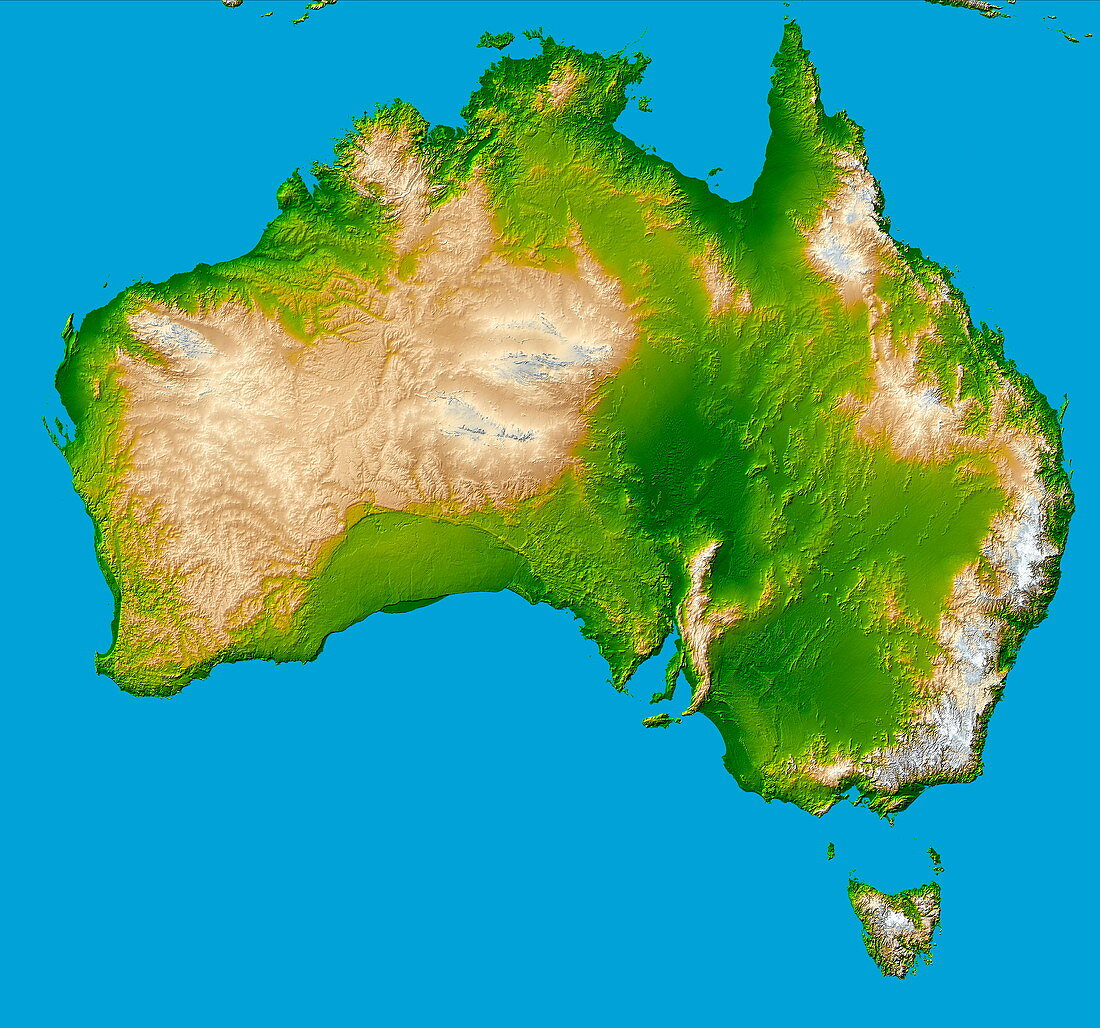
| Australia. Computer-enhanced topographical image of the continent of Australia,which covers an area of over 7.5 million square kilometres,and is the smallest and flattest of the continents. At far right is the Great Dividing Range (beige). The Lake Eyre Basin (dark green,centre right) is 16 metres below sea level and is one of the world's largest drainage systems. The green upside-down 'U' (centre left) is the Nullarbor Plain,a low- lying limestone plateau. The island of Tasmania is at bottom right. This image was obtained by combining shading and colour coding of topographic height. The data were acquired on the Shuttle Radar Topographic Mission (SRTM,Space Shuttle Endeavour,February 2000) | |
| Licence : | Libre de droits |
| Crédit: | Science Photo Library / NASA |
| Model Release : | Non requis |
| Property Release : | Non requis |
| Restrictions : | - |
Prix pour cette image À partir de 29 €
Pour une utilisation numérique (72 dpi)
À partir de 29 €
Pour un usage d'impression (300 dpi)
À partir de 325 €
Mots clés
- 21ème siècle,
- altitude,
- Australie,
- coloré,
- colorié,
- colorisé,
- continent,
- de l'espace,
- désert,
- élévation,
- géographie,
- géographique,
- hauteur,
- île,
- îles,
- image satellite,
- le plus petit,
- mission,
- mission de topographie radar de la navette,
- navette radar topographique,
- navette spaciale Endeavour,
- observation de la terre,
- ombrage,
- pays,
- satellite,
- shuttle radar topography mission,
- SRTM,
- Tasmanie,
- terre,
- végétation,
- visualisation,
- XX1ème siècle