New York City,USA,satellite image
Numéro d’image : 11749356
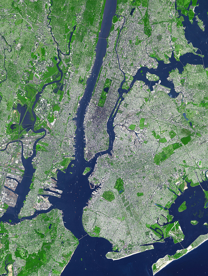
| New York City,USA,satellite image. North is at top. The island of Manhattan is at upper centre,bordered by the Hudson (left) and East (right) rivers. Built up areas are grey,parks and leafy areas are green and water is blue. Central Park appears as a green rectangle in the middle of Manhattan,with a lake in the centre. Parts of Long Island,to the right of New York Bay (lower,centre),and Staten Island,to the left of New York Bay,are also visible. The image covers an area of 27x37 kilometres and was taken by the ASTER (Advanced Spaceborne Thermal Emission and Reflection Radiometer) instrument on the Terra satellite on 8th September,2002 | |
| Licence : | Droits gérés |
| Crédit: | Science Photo Library / JAPAN ASTER SCIENCE TEAM / JAROS, AND U.S. / ERSDAC / METI / GSFC / NASA |
| Taille de l’image : | 2500 px × 3313 px |
| Model Release : | Non requis |
| Property Release : | Non requis |
| Restrictions : | - |
Prix pour cette image À partir de 45 €
Produit vendu
(Calendrier, Carte postale, Carte de vœux, Impression sur textile, Packaging etc)
À partir de 45 €
Usage commercial
(Affichage, Annonce presse, Annonce TV, Carte, Digital - hors rés. sociaux, Digital - rés. sociaux etc)
À partir de 45 €
Éditorial
(Digital, Journal, Livre, Livre pratique, Magazine, Télévision etc)
À partir de 60 €
Usage non-commercial
(Digital - hors rés. sociaux, Digital - rés. sociaux etc)
À partir de 120 €
Mots clés
- 2002,
- 21ème siècle,
- américain,
- Amérique du Nord,
- aster,
- Brooklyn,
- central park,
- de l'espace,
- East River,
- Etats-Unis,
- fleuve Hudson,
- géographie,
- géographique,
- image satellite,
- Long Island,
- N/A,
- New Jersey,
- New York,
- New York city,
- NYC,
- observation de la terre,
- Queens,
- radiomètre,
- représentation,
- rivière Hudson,
- satellite,
- Staten Island,
- terra,
- terre,
- urbain,
- US,
- USA,
- ville,
- vue d'oeil d'oiseau,
- XX1ème siècle