Shanghai and the Yangtze,1989
Numéro d’image : 11749158
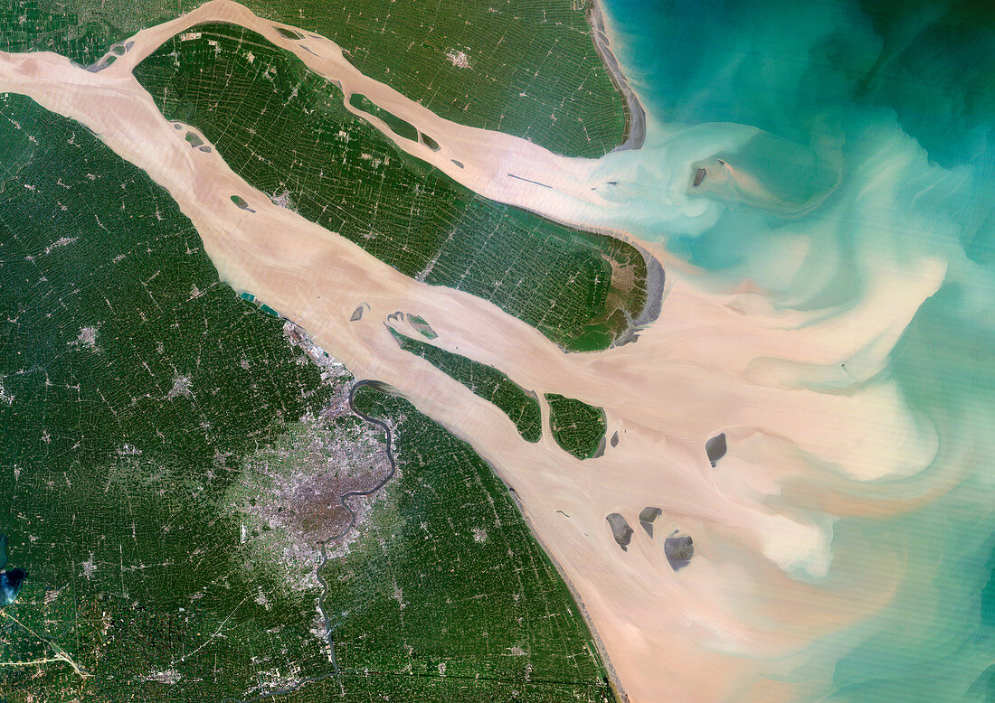
| Shanghai and the Yangtze,1989. Image to of two. Shanghai,visible as a grey conurbation towards the bottom left,is one of the largest cities in the world and has grown to be the world's busiest port. The Yangtze river drains much of China,carrying sediment and silt over 6000 kilometres from the remote,westerly highland regions of China until it reaches the East China Sea,just above Shanghai. During the 1990s,Shanghai was declared a Special Economic Development Zone and saw huge investment and development. The subsequent effects upon the environment are visible when comparing a satellite image from 2001 (see image E780/1231). There was a greater distribution of vegetation (green) and less sediment deposition prior to the development of the area. Photographed by NASA's Landsat 5 satellite | |
| Licence : | Droits gérés |
| Crédit: | Science Photo Library / Planetobserver |
| Taille de l’image : | 4961 px × 3508 px |
| Model Release : | Non requis |
| Property Release : | Non requis |
| Restrictions : | - |
Prix pour cette image À partir de 45 €
Produit vendu
(Calendrier, Carte postale, Carte de vœux, Impression sur textile, Packaging etc)
À partir de 45 €
Usage commercial
(Affichage, Annonce presse, Annonce TV, Carte, Digital - hors rés. sociaux, Digital - rés. sociaux etc)
À partir de 45 €
Éditorial
(Digital, Journal, Livre, Livre pratique, Magazine, Télévision etc)
À partir de 60 €
Usage non-commercial
(Digital - hors rés. sociaux, Digital - rés. sociaux etc)
À partir de 120 €