Antananarivo,Madagascar
Numéro d’image : 11749063
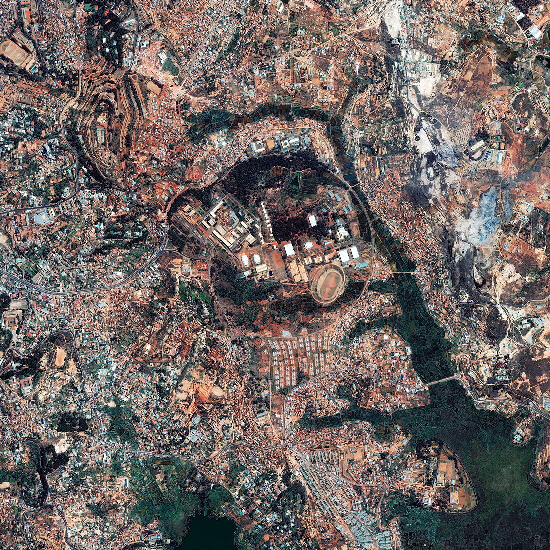
| Antananarivo,Madagascar. Satellite image of Antananarivo,the capital and largest city of Madagascar. Atananarivo,which means 'city of the thousands',is built on the slopes of a 1430 metres high ridge. At the top of the ridge is the former Merina royal residence,which was destroyed by a fire in 1995. Below,in descending order,are the administrative and financial areas and the commercial quarter. Image taken on 13 December 2001 by Space Imaging's Ikonos satellite | |
| Licence : | Droits gérés |
| Crédit: | Science Photo Library / Geoeye |
| Taille de l’image : | 3000 px × 3000 px |
| Model Release : | Non requis |
| Property Release : | Non requis |
| Restrictions : | - |
Prix pour cette image À partir de 45 €
Produit vendu
(Calendrier, Carte postale, Carte de vœux, Impression sur textile, Packaging etc)
À partir de 45 €
Usage commercial
(Affichage, Annonce presse, Annonce TV, Carte, Digital - hors rés. sociaux, Digital - rés. sociaux etc)
À partir de 45 €
Éditorial
(Digital, Journal, Livre, Livre pratique, Magazine, Télévision etc)
À partir de 60 €
Usage non-commercial
(Digital - hors rés. sociaux, Digital - rés. sociaux etc)
À partir de 120 €