Oakland city centre,USA
Numéro d’image : 11748924
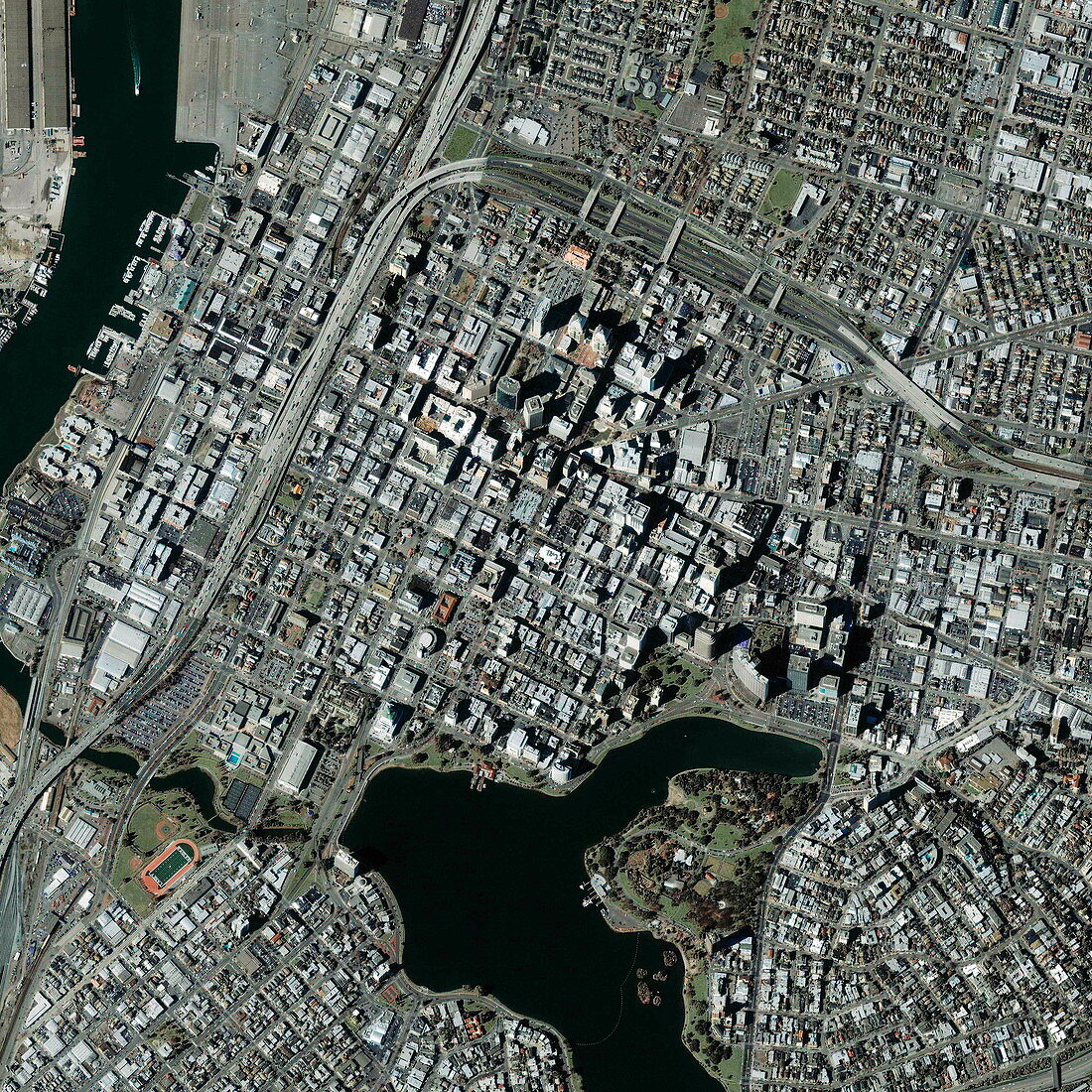
| Oakland. Satellite image of the city centre of Oakland,California,USA. North is at right. The skyscrapers of the city centre are at upper centre (casting long shadows). Lake Merrit is at bottom centre. A channel (lower left) leads from the lake to Oakland Inner Harbour (top left,docks seen) in San Francisco Bay. Major transport links include motorways such as Interstate 880 (down left) and Interstate 980 (branching off to upper right). The area at lower left,between the lake and motorway,is Laney College. The area shown here is about 3.5 kilometres across. Image taken by the Ikonos satellite on 18 February 2003 | |
| Licence : | Droits gérés |
| Crédit: | Science Photo Library / Geoeye |
| Taille de l’image : | 3000 px × 3000 px |
| Model Release : | Non requis |
| Property Release : | Non requis |
| Restrictions : | - |
Prix pour cette image À partir de 45 €
Produit vendu
(Calendrier, Carte postale, Carte de vœux, Impression sur textile, Packaging etc)
À partir de 45 €
Usage commercial
(Affichage, Annonce presse, Annonce TV, Carte, Digital - hors rés. sociaux, Digital - rés. sociaux etc)
À partir de 45 €
Éditorial
(Digital, Journal, Livre, Livre pratique, Magazine, Télévision etc)
À partir de 60 €
Usage non-commercial
(Digital - hors rés. sociaux, Digital - rés. sociaux etc)
À partir de 120 €