New Orleans French Quarter,USA
Numéro d’image : 11748918
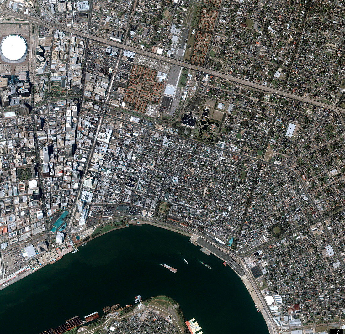
| New Orleans. Satellite image of the French Quarter (centre) of New Orleans,Louisiana,USA. North is at upper right. The French Quarter is an area of historical buildings forming the lower half of the central square area bounded by roads and by the Mississippi River (across bottom). The buildings mostly date to the time when the Spanish ruled the area in the 18th and early 19th century. High-rise buildings and skyscrapers (down left) form the modern city centre. The white dome at top left is the Louisiana Superdome (built from 1971-1975). The area shown is about 3 kilometres across. Image taken by the Ikonos satellite on 28 August 2002 | |
| Licence : | Droits gérés |
| Crédit: | Science Photo Library / Geoeye |
| Taille de l’image : | 3000 px × 2908 px |
| Model Release : | Non requis |
| Property Release : | Non requis |
| Restrictions : | - |
Prix pour cette image À partir de 45 €
Produit vendu
(Calendrier, Carte postale, Carte de vœux, Impression sur textile, Packaging etc)
À partir de 45 €
Usage commercial
(Affichage, Annonce presse, Annonce TV, Carte, Digital - hors rés. sociaux, Digital - rés. sociaux etc)
À partir de 45 €
Éditorial
(Digital, Journal, Livre, Livre pratique, Magazine, Télévision etc)
À partir de 60 €
Usage non-commercial
(Digital - hors rés. sociaux, Digital - rés. sociaux etc)
À partir de 120 €
Mots clés
- 21ème siècle,
- américain,
- Amérique du Nord,
- attraction touristique,
- centre ville,
- de l'espace,
- Etats-Unis,
- géographie,
- géographique,
- histoire,
- historique,
- Ikonos,
- image satellite,
- Louisiane,
- N/A,
- Nouvelle Orléans,
- observation de la terre,
- rivière,
- satellite,
- stade,
- stadium,
- tourisme,
- transport,
- urbain,
- US,
- USA,
- ville,
- XX1ème siècle