Munich city centre,Germany
Numéro d’image : 11748915
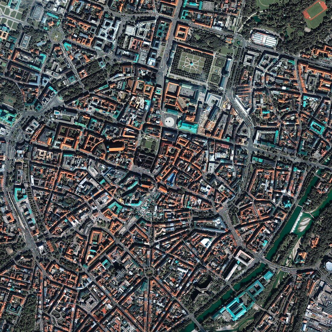
| Munich. Satellite image of the historical city centre (the Altstadt) of Munich,Bavaria,Germany. North is at top. The area shown here is about 3 kilometres across. A ring-shaped road runs around the Altstadt,and numerous buildings,squares and marketplaces are seen in this area. The River Isar is seen at lower right. Image taken by the Ikonos satellite on 3 September 2001 | |
| Licence : | Droits gérés |
| Crédit: | Science Photo Library / Geoeye |
| Taille de l’image : | 2925 px × 2925 px |
| Model Release : | Non requis |
| Property Release : | Non requis |
| Restrictions : | - |
Prix pour cette image À partir de 45 €
Produit vendu
(Calendrier, Carte postale, Carte de vœux, Impression sur textile, Packaging etc)
À partir de 45 €
Usage commercial
(Affichage, Annonce presse, Annonce TV, Carte, Digital - hors rés. sociaux, Digital - rés. sociaux etc)
À partir de 45 €
Éditorial
(Digital, Journal, Livre, Livre pratique, Magazine, Télévision etc)
À partir de 60 €
Usage non-commercial
(Digital - hors rés. sociaux, Digital - rés. sociaux etc)
À partir de 120 €