Central London,UK
Numéro d’image : 11748908
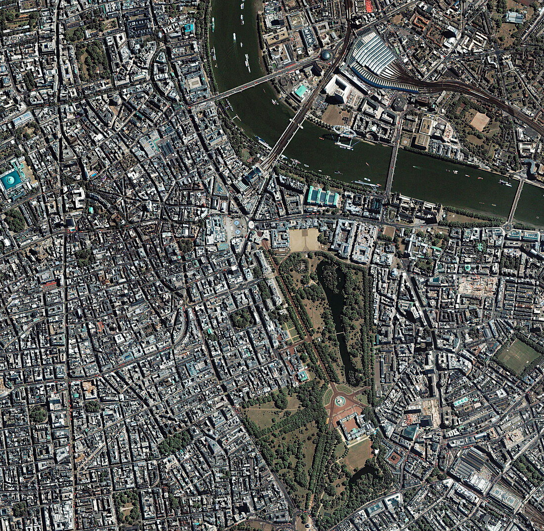
| Central London. Satellite image of the area around St James's Park (lower right),London,UK. North is at left. The area shown is about 3.2 kilometres across. The River Thames is at upper right. Other visible landmarks include Buckingham Palace (in St James's Park); Waterloo train station (white,top right,next to a white building); and the London Eye (on the banks of the River Thames),between Westminster Bridge (right) and Hungerford Bridge (left). London,the capital city of the UK,is one of the largest cities in the world. Image taken by the Ikonos satellite on 8 August 2003 | |
| Licence : | Droits gérés |
| Crédit: | Science Photo Library / Geoeye |
| Taille de l’image : | 3000 px × 2928 px |
| Model Release : | Non requis |
| Property Release : | Non requis |
| Restrictions : | - |
Prix pour cette image À partir de 45 €
Produit vendu
(Calendrier, Carte postale, Carte de vœux, Impression sur textile, Packaging etc)
À partir de 45 €
Usage commercial
(Affichage, Annonce presse, Annonce TV, Carte, Digital - hors rés. sociaux, Digital - rés. sociaux etc)
À partir de 45 €
Éditorial
(Digital, Journal, Livre, Livre pratique, Magazine, Télévision etc)
À partir de 60 €
Usage non-commercial
(Digital - hors rés. sociaux, Digital - rés. sociaux etc)
À partir de 120 €
Mots clés
- 21ème siècle,
- anglais,
- Angleterre,
- britannique,
- Buckingham Palace,
- centre ville,
- de l'espace,
- Europe,
- européen,
- géographie,
- géographique,
- Grande Bretagne,
- Grande-Bretagne,
- Ikonos,
- image satellite,
- London eye,
- londres,
- Millenium Wheel,
- observation de la terre,
- parc St James,
- rivière,
- Royaume Uni,
- Royaume-Uni,
- satellite,
- Tamise,
- urbain,
- ville,
- XX1ème siècle