Providence,Rhode Island
Numéro d’image : 11748780
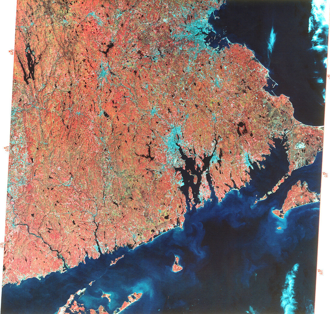
| Providence,Rhode Island,USA,combined infrared and visible satellite image. North is at top. The city of Providence is the blue area at centre,on the northwestern edge of Narragansett Bay. This bay opens onto Rhode Island Sound (lower right),part of the Atlantic Ocean. At lower left is the northeastern tip of Long Island,New York State. At far right is the base of the Cape Cod peninsula in Massachusetts. The large blue expanse at upper right is the city of Boston,Massachusetts. Rhode Island is the smallest state of the USA. Photographed by Landsat 1 on 8th October 1972 | |
| Licence : | Droits gérés |
| Crédit: | Science Photo Library / MDA Information Systems |
| Taille de l’image : | 5065 px × 4823 px |
| Model Release : | Non requis |
| Property Release : | Non requis |
| Restrictions : | - |
Prix pour cette image À partir de 45 €
Produit vendu
(Calendrier, Carte postale, Carte de vœux, Impression sur textile, Packaging etc)
À partir de 45 €
Usage commercial
(Affichage, Annonce presse, Annonce TV, Carte, Digital - hors rés. sociaux, Digital - rés. sociaux etc)
À partir de 45 €
Éditorial
(Digital, Journal, Livre, Livre pratique, Magazine, Télévision etc)
À partir de 60 €
Usage non-commercial
(Digital - hors rés. sociaux, Digital - rés. sociaux etc)
À partir de 120 €