Cardiff and Barry,land use map
Numéro d’image : 11748672
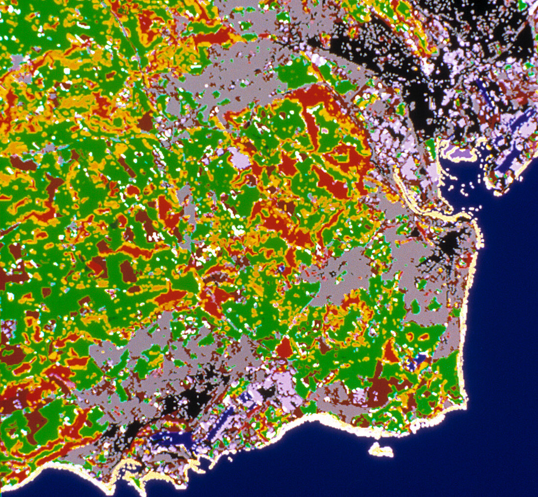
| Cardiff. Coloured map of land use in the area around Cardiff,Wales,derived from satellite data. Cardiff is the large black/grey area near the top of the frame. Black indicates urban development,grey indicates suburban developments. Light grey indicates the dock areas of the city. Near bottom left is the town of Barry,also with urban,suburban and port areas. Between the two is countryside: with pastures (green),rough grass (yellow) and bracken (red) | |
| Licence : | Droits gérés |
| Crédit: | Science Photo Library / INSTITUTE OF TERRESTRIAL ECOLOGY |
| Taille de l’image : | 3934 px × 3638 px |
| Model Release : | Non requis |
| Property Release : | Non requis |
| Restrictions : | - |
Prix pour cette image À partir de 45 €
Produit vendu
(Calendrier, Carte postale, Carte de vœux, Impression sur textile, Packaging etc)
À partir de 45 €
Usage commercial
(Affichage, Annonce presse, Annonce TV, Carte, Digital - hors rés. sociaux, Digital - rés. sociaux etc)
À partir de 45 €
Éditorial
(Digital, Journal, Livre, Livre pratique, Magazine, Télévision etc)
À partir de 60 €
Usage non-commercial
(Digital - hors rés. sociaux, Digital - rés. sociaux etc)
À partir de 120 €