Amsterdam and the Ijsselmeer,Holland
Numéro d’image : 11748427
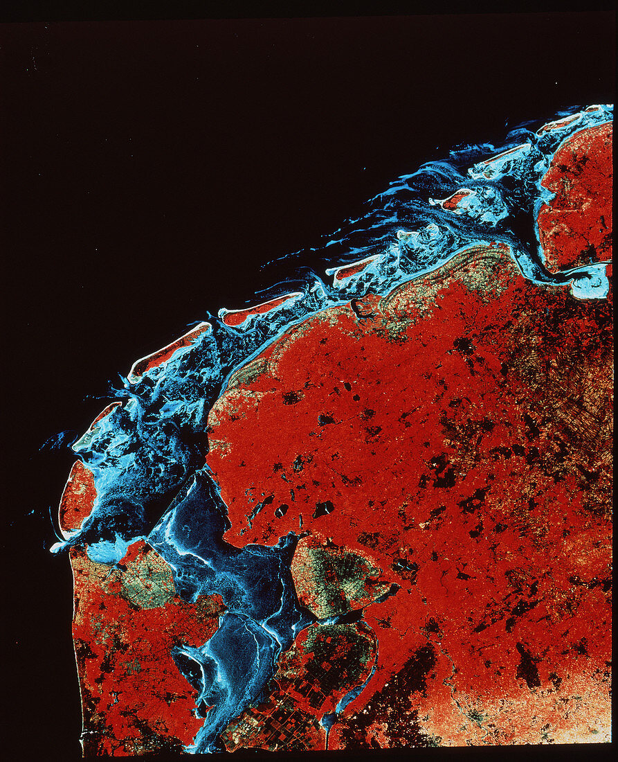
| Land reclamation project,seen from space. Satellite image of part of the Netherlands,showing the land reclamation projects in the Ijsselmeer. The area was once a shallow inlet of the North Sea known as the Zuider Zee. Between 1927 and 1932 a dam,called the Afluitsdijk,was built across the mouth of the sea. The water on the inside of the dam became the Ijsselmeer. Large areas of land were then dammed off and drained,forming new,fertile land for agriculture. These areas are called polders. Seen here as green,the largest are the North-East polder (just below centre) and Flevoland (bottom centre). This image was gathered by a Landsat satellite in July 1985 | |
| Licence : | Droits gérés |
| Crédit: | Science Photo Library / Geospace |
| Taille de l’image : | 3497 px × 4309 px |
| Model Release : | Non requis |
| Property Release : | Non requis |
| Restrictions : | - |
Prix pour cette image À partir de 45 €
Produit vendu
(Calendrier, Carte postale, Carte de vœux, Impression sur textile, Packaging etc)
À partir de 45 €
Usage commercial
(Affichage, Annonce presse, Annonce TV, Carte, Digital - hors rés. sociaux, Digital - rés. sociaux etc)
À partir de 45 €
Éditorial
(Digital, Journal, Livre, Livre pratique, Magazine, Télévision etc)
À partir de 60 €
Usage non-commercial
(Digital - hors rés. sociaux, Digital - rés. sociaux etc)
À partir de 120 €
Mots clés
- agricole,
- agriculture,
- Amsterdam,
- bonification des terres,
- géographie,
- Hollande,
- image satellite,
- imagerie satellitaire,
- imagerie satellite,
- imagine de Landsat,
- Landsat,
- mise en valeur des terres,
- Pays-Bas,
- plante,
- polder,
- prise,
- programme de Landsat,
- récupération,
- restauration,
- réutilisation des terres,
- terre,
- utilisation des terres