Landsat satellite image of US & Canadian farmland
Numéro d’image : 11747710
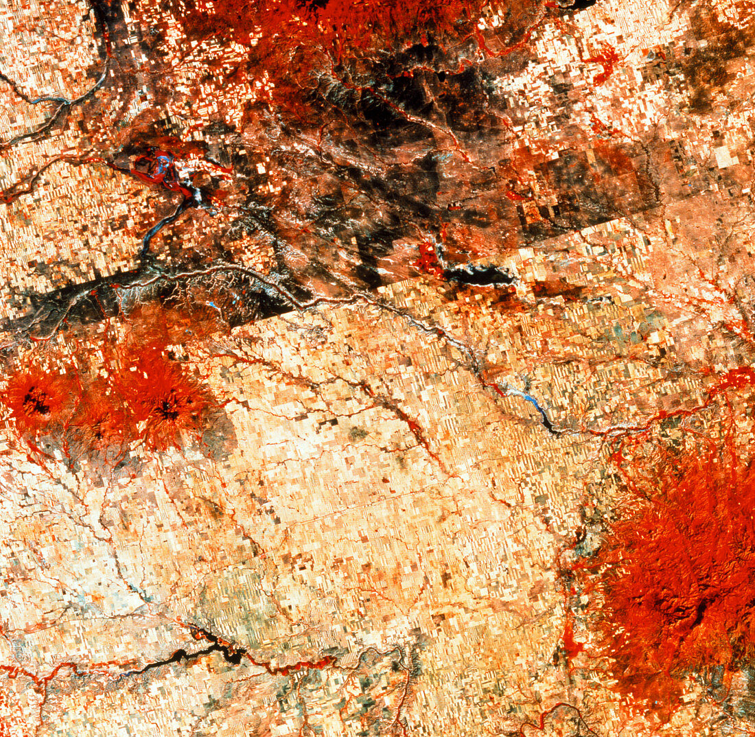
| Mechanised farming. Coloured LANDSAT satellite image of land-use patterns on the border of USA and Canada. North is at top. Photographed in the infrared colour range,thickly vegetated mountains appear red,as does vegetation on riverbanks. The straight border between Alberta,Canada (at top) and the Hingham area of Montana,USA (lower frame) runs diagonally from centre left to upper right. On the USA side,patterns of farmland show intense cultivation. Different colour fields reveal crops at different stages of growth. In Canada,planta- tions of forest (brown) are seen. The Milk river is at centre. Satellite image taken in September | |
| Licence : | Droits gérés |
| Crédit: | Science Photo Library / MDA Information Systems |
| Taille de l’image : | 2858 px × 2791 px |
| Model Release : | Non requis |
| Property Release : | Non requis |
| Restrictions : | - |
Prix pour cette image À partir de 45 €
Produit vendu
(Calendrier, Carte postale, Carte de vœux, Impression sur textile, Packaging etc)
À partir de 45 €
Usage commercial
(Affichage, Annonce presse, Annonce TV, Carte, Digital - hors rés. sociaux, Digital - rés. sociaux etc)
À partir de 45 €
Éditorial
(Digital, Journal, Livre, Livre pratique, Magazine, Télévision etc)
À partir de 60 €
Usage non-commercial
(Digital - hors rés. sociaux, Digital - rés. sociaux etc)
À partir de 120 €