Landsat image of a farm in Bedfordshire,England
Numéro d’image : 11747705
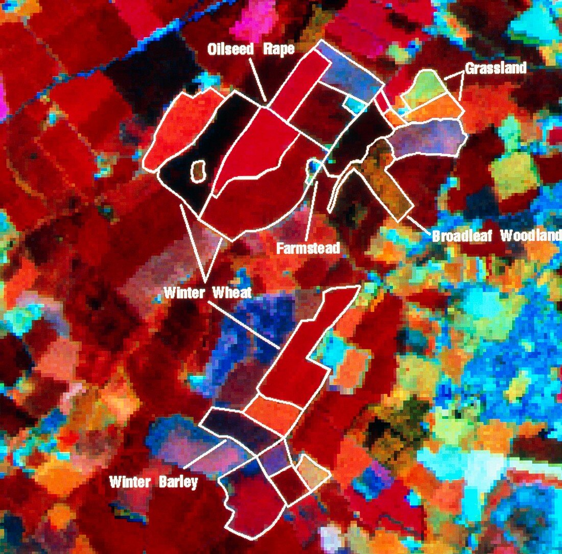
| Farmland from space. Digitised Landsat image of a typical farm in Bedfordshire,England,showing land use. The boundaries of crop fields,broadleaf woodland,grassland,and a farmstead are demar- cated. Agricultural crops include barley,oilseed rape (red),and winter wheat (shades of brown,younger wheat is lighter in colour). The Landsat Thematic Mapper used here produces an image of high-resolution (30 metres). It records reflected radiation in 3 wavebands: near infra-red,mid infra-red and red. This produces the red,green and blue on the image,useful in determining plant type. Photographed by Landsat 5 on 12 June 1992,at an altitude of 705 kilometres | |
| Licence : | Droits gérés |
| Crédit: | Science Photo Library / NRSC LTD |
| Taille de l’image : | 4261 px × 4205 px |
| Model Release : | Non requis |
| Property Release : | Non requis |
| Restrictions : | - |
Prix pour cette image À partir de 45 €
Produit vendu
(Calendrier, Carte postale, Carte de vœux, Impression sur textile, Packaging etc)
À partir de 45 €
Usage commercial
(Affichage, Annonce presse, Annonce TV, Carte, Digital - hors rés. sociaux, Digital - rés. sociaux etc)
À partir de 45 €
Éditorial
(Digital, Journal, Livre, Livre pratique, Magazine, Télévision etc)
À partir de 60 €
Usage non-commercial
(Digital - hors rés. sociaux, Digital - rés. sociaux etc)
À partir de 120 €