Dardanelles,satellite image
Numéro d’image : 11746457
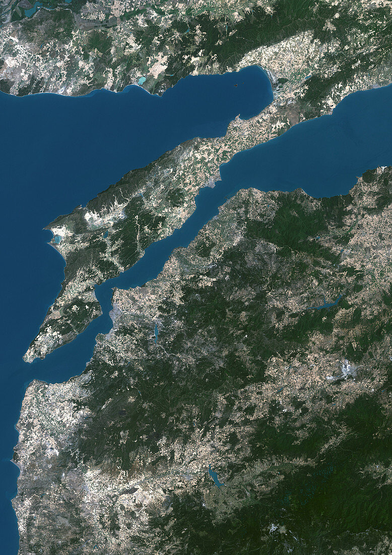
| Dardanelles. Satellite image of the Dardanelles (centre) in northwestern Turkey,a 61 kilometre long strait that separates European Turkey (top) from Asiatic Turkey (bottom). North is at top. The maximum width is 7 kilometres and in the area known as the Narrows,the distance is no more than 1,600 metres. It is a vital transportation route between the Black sea and the Mediterranean Sea,connecting the Aegean Sea (left) to the Sea of Marmara (where the strait opens up at far right) | |
| Licence : | Droits gérés |
| Crédit: | Science Photo Library / Planetobserver |
| Taille de l’image : | 2492 px × 3525 px |
| Model Release : | Non requis |
| Property Release : | Non requis |
| Restrictions : | - |
Prix pour cette image À partir de 45 €
Produit vendu
(Calendrier, Carte postale, Carte de vœux, Impression sur textile, Packaging etc)
À partir de 45 €
Usage commercial
(Affichage, Annonce presse, Annonce TV, Carte, Digital - hors rés. sociaux, Digital - rés. sociaux etc)
À partir de 45 €
Éditorial
(Digital, Journal, Livre, Livre pratique, Magazine, Télévision etc)
À partir de 60 €
Usage non-commercial
(Digital - hors rés. sociaux, Digital - rés. sociaux etc)
À partir de 120 €
Mots clés
- adoption,
- Anatolie,
- asiatique,
- Asie,
- Asie mineure,
- connexion,
- couloir,
- DARDANELLES,
- de l'espace,
- détroit,
- environnement,
- étroit,
- Europe,
- européen,
- géographie,
- géographique,
- image satellite,
- itinéraire,
- liaison,
- mer,
- Mer Egée,
- mer égée,
- observation de la terre,
- passage,
- raccordement,
- route,
- ruban,
- satellite,
- se relier,
- séparation,
- séparer,
- terre,
- transport,
- Turquie,
- voie