La Palma island
Numéro d’image : 11746373
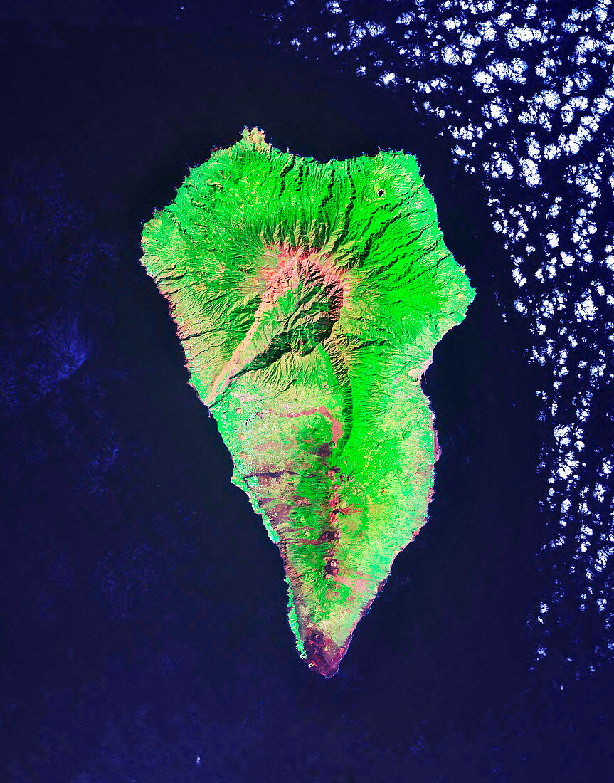
| La Palma island,satellite image. North is at top. La Palma is a volcanic island in the Canary Islands. This archipelago is part of Spain,and lies over 100 kilometres west of northern Africa in the Atlantic Ocean. La Palma is dominated by its large central crater,Caldera de Taburiente. Numerous other craters can be seen running down the centre of the lower part of the island. Geological studies of the island have revealed that a major eruption could cause the northwestern part of the island to slip into the sea,which could generate an enormous tsunami (called a megatsunami). This would cross the Atlantic Ocean in a few hours and lay waste to eastern North America | |
| Licence : | Droits gérés |
| Crédit: | Science Photo Library / NASA |
| Taille de l’image : | 3516 px × 4479 px |
| Model Release : | Non requis |
| Property Release : | Non requis |
| Restrictions : | - |
Prix pour cette image À partir de 45 €
Produit vendu
(Calendrier, Carte postale, Carte de vœux, Impression sur textile, Packaging etc)
À partir de 45 €
Usage commercial
(Affichage, Annonce presse, Annonce TV, Carte, Digital - hors rés. sociaux, Digital - rés. sociaux etc)
À partir de 45 €
Éditorial
(Digital, Journal, Livre, Livre pratique, Magazine, Télévision etc)
À partir de 60 €
Usage non-commercial
(Digital - hors rés. sociaux, Digital - rés. sociaux etc)
À partir de 120 €