Iceland
Numéro d’image : 11746345
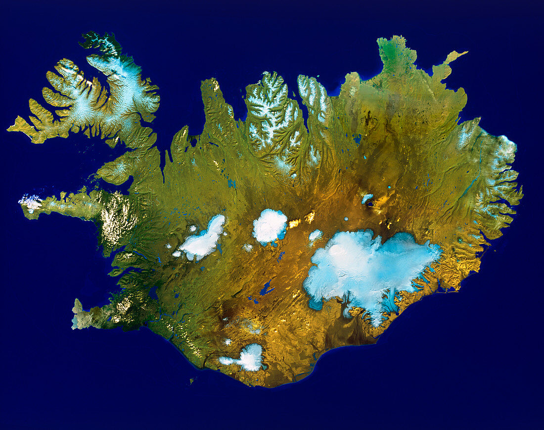
| Iceland. Satellite image of the island country of Iceland,in the north Atlantic Ocean. North is at top. Vegetation is green,arid areas are brown,snow & ice is blue/white,and water is dark blue. The capital city Reykjavik is at lower left. The Vatnajokull icefield (lower right) covers an area of over 8,000 square kilometres,and its highest point is over 2,000 metres. Iceland is situated at the north end of the Mid-Atlantic Ridge and only 21% of the land is inhabitable | |
| Licence : | Droits gérés |
| Crédit: | Science Photo Library / Worldsat International |
| Taille de l’image : | 4961 px × 3913 px |
| Model Release : | Non requis |
| Property Release : | Non requis |
| Restrictions : |
|
Prix pour cette image À partir de 45 €
Produit vendu
(Calendrier, Carte postale, Carte de vœux, Impression sur textile, Packaging etc)
À partir de 45 €
Usage commercial
(Affichage, Annonce presse, Annonce TV, Carte, Digital - hors rés. sociaux, Digital - rés. sociaux etc)
À partir de 45 €
Éditorial
(Digital, Journal, Livre, Livre pratique, Magazine, Télévision etc)
À partir de 60 €
Usage non-commercial
(Digital - hors rés. sociaux, Digital - rés. sociaux etc)
À partir de 120 €