Etosha National Park
Numéro d’image : 11746256
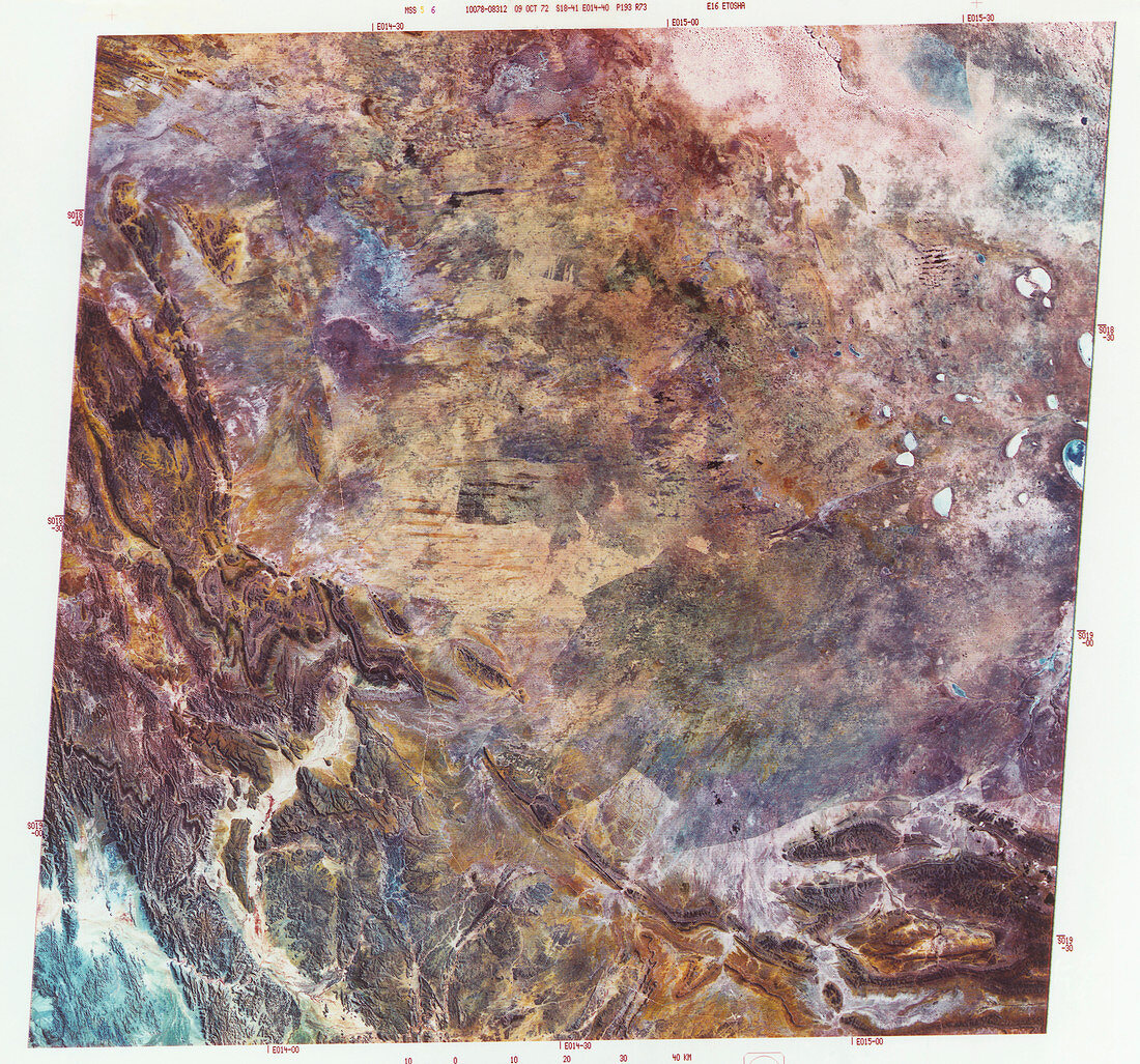
| Etosha National Park. Combined infrared and visible satellite image of the Etosha National Park,a game reserve in Namibia. North is at top. The park is dominated by the Etosha Pan,a flat salt pan formed as a large lake dried out millions of years ago. The park covers over 23,000 square kilometres,and is home to a wide variety of wildlife. The image is 186 kilometres wide. Photographed by Landsat 1 on 9th October 1972 | |
| Licence : | Droits gérés |
| Crédit: | Science Photo Library / MDA Information Systems |
| Taille de l’image : | 4977 px × 4647 px |
| Model Release : | Non requis |
| Property Release : | Non requis |
| Restrictions : | - |
Prix pour cette image À partir de 45 €
Produit vendu
(Calendrier, Carte postale, Carte de vœux, Impression sur textile, Packaging etc)
À partir de 45 €
Usage commercial
(Affichage, Annonce presse, Annonce TV, Carte, Digital - hors rés. sociaux, Digital - rés. sociaux etc)
À partir de 45 €
Éditorial
(Digital, Journal, Livre, Livre pratique, Magazine, Télévision etc)
À partir de 60 €
Usage non-commercial
(Digital - hors rés. sociaux, Digital - rés. sociaux etc)
À partir de 120 €