Deforestation in Rondonia,Brazil,2001
Numéro d’image : 11746224
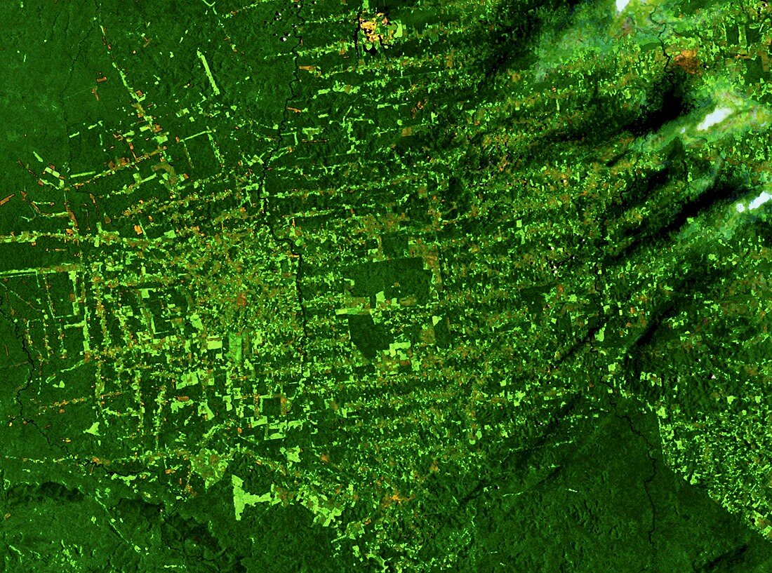
| Deforestation in Rondonia,Brazil. Image 4 of 4. Satellite image of part of the state of Rondonia,Brazil,showing deforested areas (light green). Throughout much of the 1980s,deforestation in Brazil eliminated more than 15,000 square kilometres of forest per year. Deforestation is normally undertaken to create grazing areas for cattle. The removal of trees leaves soil exposed to rapid erosion by water,leading to the removal of valuable top soil. Photographed on 7th February 2001 by NASA's Landsat-7 satellite | |
| Licence : | Droits gérés |
| Crédit: | Science Photo Library / NASA |
| Taille de l’image : | 3500 px × 2599 px |
| Model Release : | Non requis |
| Property Release : | Non requis |
| Restrictions : | - |
Prix pour cette image À partir de 45 €
Produit vendu
(Calendrier, Carte postale, Carte de vœux, Impression sur textile, Packaging etc)
À partir de 45 €
Usage commercial
(Affichage, Annonce presse, Annonce TV, Carte, Digital - hors rés. sociaux, Digital - rés. sociaux etc)
À partir de 45 €
Éditorial
(Digital, Journal, Livre, Livre pratique, Magazine, Télévision etc)
À partir de 60 €
Usage non-commercial
(Digital - hors rés. sociaux, Digital - rés. sociaux etc)
À partir de 120 €
Mots clés
- 2001,
- 21ème siècle,
- agricole,
- agriculture,
- Amazone,
- Amazonie,
- américain,
- Amérique du Sud,
- Brésil,
- brésilien,
- champs,
- de l'espace,
- déboisé,
- déboisement,
- déforestation,
- destruction,
- détruire,
- détruit,
- environnement,
- environnemental,
- état,
- forêt,
- forêt tropicale,
- géographie,
- géographique,
- image satellite,
- impact humain,
- NASA,
- observation de la terre,
- optique,
- rondonia,
- satellite,
- séquence,
- séries,
- vert,
- XX1ème siècle