Richat Structure,satellite image
Numéro d’image : 11745885
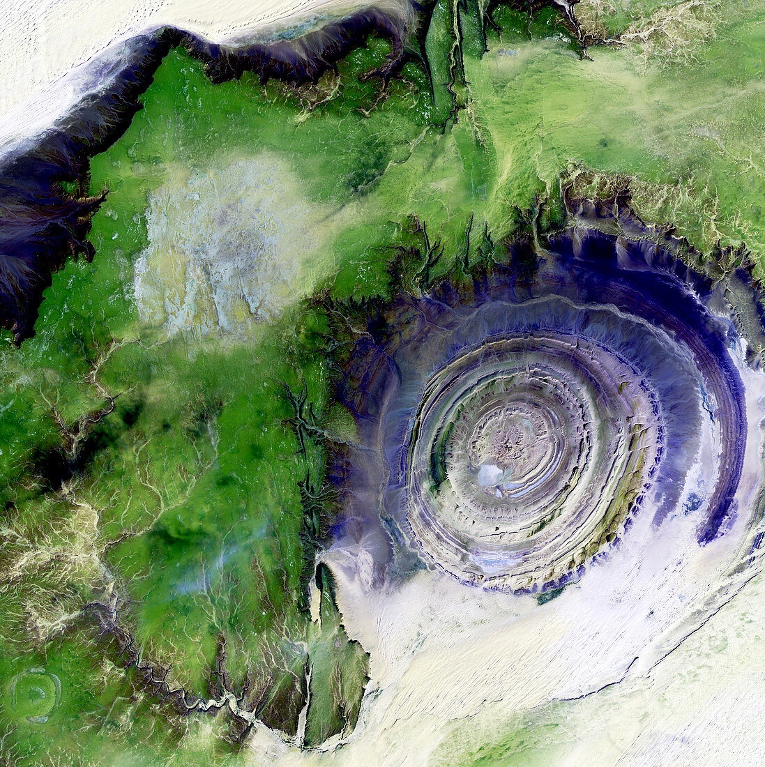
| Richat Structure,satellite image. North is at top. Desert sands are pale yellow/white (top left and lower right),while less sandy,rocky areas are green,and volcanic rocks are blue. The Richat Structure is an eroded volcanic dome in the deserts of Mauritania. As the volcanic dome eroded,these onion-like layers of rock were exposed. The structure is 485 metres high,and nearly 50 kilometres across. It is in the Maur Adrar Desert,in the Western Sahara. The area shown in this image is around 66 kilometres wide. The image data includes infrared wavelengths,and was obtained on 11 January 2001,by the Landsat 7 satellite | |
| Licence : | Droits gérés |
| Crédit: | Science Photo Library / NASA |
| Taille de l’image : | 4800 px × 4811 px |
| Model Release : | Non requis |
| Property Release : | Non requis |
| Restrictions : | - |
Prix pour cette image À partir de 45 €
Produit vendu
(Calendrier, Carte postale, Carte de vœux, Impression sur textile, Packaging etc)
À partir de 45 €
Usage commercial
(Affichage, Annonce presse, Annonce TV, Carte, Digital - hors rés. sociaux, Digital - rés. sociaux etc)
À partir de 45 €
Éditorial
(Digital, Journal, Livre, Livre pratique, Magazine, Télévision etc)
À partir de 60 €
Usage non-commercial
(Digital - hors rés. sociaux, Digital - rés. sociaux etc)
À partir de 120 €
Mots clés
- 2000,
- 2001,
- 21ème siècle,
- africain,
- Afrique,
- altéré,
- aride,
- aridité,
- chaud,
- de l'espace,
- désert,
- environnement,
- érodé,
- géographie,
- géographie physique,
- géographique,
- géologie,
- géologique,
- image satellite,
- infrarouge,
- IR,
- janvier,
- landsat 7,
- Mauritanie,
- mauritien,
- nature,
- observation de la terre,
- rocheux,
- sableux,
- sablonneux,
- Sahara,
- saharien,
- satellite,
- science de la terre,
- sec,
- terre,
- traversé,
- volcanique,
- XX1ème siècle