Sahara Desert,satellite image
Numéro d’image : 11745875
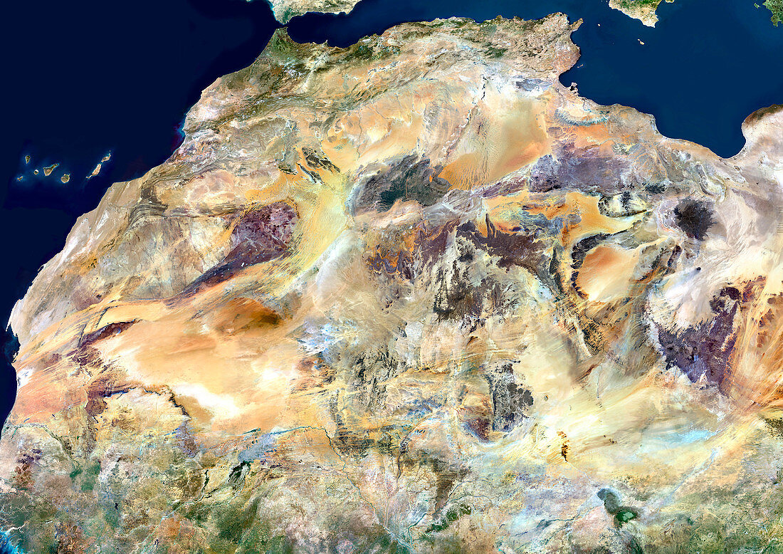
| Sahara Desert,satellite image. North is at top. The Sahara Desert in Africa is the world's largest desert. It is mainly sand and volcanic rocks. This is the north-western part of the Sahara,with the Canary Islands seen in the Atlantic Ocean at upper left,and the Mediterranean Sea seen at upper centre and upper right. The colours seen here are due to the differing volcanic rocks and minerals present in the region. This view extends south to Senegal (lower left) and east as far as the eastern part of Libya (far right) and northern Chad (lower right). It includes all or most of Morocco,Algeria,Libya and Mauritania,and parts of Mali,Niger,and Chad. The area seen here is over 3000 kilometres across | |
| Licence : | Droits gérés |
| Crédit: | Science Photo Library / Planetobserver |
| Taille de l’image : | 4961 px × 3508 px |
| Model Release : | Non requis |
| Property Release : | Non requis |
| Restrictions : | - |
Prix pour cette image À partir de 45 €
Produit vendu
(Calendrier, Carte postale, Carte de vœux, Impression sur textile, Packaging etc)
À partir de 45 €
Usage commercial
(Affichage, Annonce presse, Annonce TV, Carte, Digital - hors rés. sociaux, Digital - rés. sociaux etc)
À partir de 45 €
Éditorial
(Digital, Journal, Livre, Livre pratique, Magazine, Télévision etc)
À partir de 60 €
Usage non-commercial
(Digital - hors rés. sociaux, Digital - rés. sociaux etc)
À partir de 120 €
Mots clés
- africain,
- Afrique,
- Afrique du Nord,
- Algerie,
- aride,
- aridité,
- de l'espace,
- désert,
- désert du Sahara,
- environnement,
- géographie,
- géographie physique,
- géographique,
- image satellite,
- le plus grand,
- Libye,
- Mali,
- Maroc,
- Mauritanie,
- nature,
- Niger,
- observation de la terre,
- Sahara,
- satellite,
- science de la terre,
- sec,
- Tchad