Lake Etosha,satellite image
Numéro d’image : 11745497
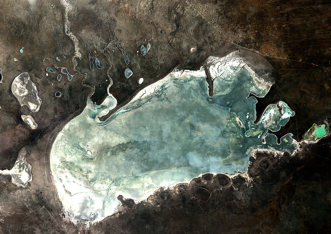
| Lake Etosha,Namibia,satellite image. North is at top. This is a salt basin that fills with water at the end of the rainy season. Salt deposits are white. A sheen of algae and other vegetation produces the green colour,but the basin is mostly dry. This salt pan is 120 kilometres wide. Image data obtained on 2 May 1989 | |
| Licence : | Droits gérés |
| Crédit: | Science Photo Library / Planetobserver |
| Taille de l’image : | 4961 px × 3508 px |
| Model Release : | Non requis |
| Property Release : | Non requis |
| Restrictions : | - |
Prix pour cette image À partir de 45 €
Produit vendu
(Calendrier, Carte postale, Carte de vœux, Impression sur textile, Packaging etc)
À partir de 45 €
Usage commercial
(Affichage, Annonce presse, Annonce TV, Carte, Digital - hors rés. sociaux, Digital - rés. sociaux etc)
À partir de 45 €
Éditorial
(Digital, Journal, Livre, Livre pratique, Magazine, Télévision etc)
À partir de 60 €
Usage non-commercial
(Digital - hors rés. sociaux, Digital - rés. sociaux etc)
À partir de 120 €
Mots clés
- 1900,
- 1980,
- 1989,
- 20ème siècle,
- africain,
- Afrique,
- aride,
- aridité,
- croûte de sel,
- de l'espace,
- désert,
- environnement,
- géographie,
- géographie physique,
- géographique,
- hypersalin,
- image satellite,
- lac,
- mai,
- Namibie,
- Namibien,
- nature,
- observation de la terre,
- salé,
- salin,
- satellite,
- science de la terre,
- sec,
- XXème siècle