Lena River Delta,satellite image
Numéro d’image : 11745151
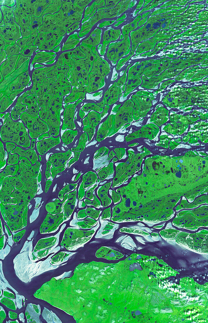
| Lena River Delta. Satellite image of part of the delta of the Lena River. North is at top. Water is blue and wetland areas are green. This river flows 4400 kilometres from south-central Russia,to this delta on the Arctic coast of north-west Russia. At the delta,the water spreads out through numerous channels,depositing its silt to build the land of the delta,before emptying into the Laptev Sea. The delta is frozen in the winter,but in summer it is a thriving wetland. Image data obtained on 16 July 2005,with the ASTER instrument on the Terra satellite | |
| Licence : | Droits gérés |
| Crédit: | Science Photo Library / ASTER SCIENCE TEAM / GSFC / NASA |
| Taille de l’image : | 4014 px × 6232 px |
| Model Release : | Non requis |
| Property Release : | Non requis |
| Restrictions : | - |
Prix pour cette image À partir de 45 €
Produit vendu
(Calendrier, Carte postale, Carte de vœux, Impression sur textile, Packaging etc)
À partir de 45 €
Usage commercial
(Affichage, Annonce presse, Annonce TV, Carte, Digital - hors rés. sociaux, Digital - rés. sociaux etc)
À partir de 45 €
Éditorial
(Digital, Journal, Livre, Livre pratique, Magazine, Télévision etc)
À partir de 60 €
Usage non-commercial
(Digital - hors rés. sociaux, Digital - rés. sociaux etc)
À partir de 120 €
Mots clés
- 2005,
- 21ème siècle,
- advanced spaceborne,
- aster,
- côte,
- côtier,
- de l'espace,
- delta,
- écologie,
- écologique,
- émission thermique et,
- environnement,
- environnemental,
- été,
- Europe,
- européen,
- géographie,
- géographique,
- image satellite,
- marais,
- marécage,
- marécages,
- nature,
- observation de la terre,
- radiomètre réflecteur,
- rivière,
- russe,
- Russie,
- satellite,
- sédiment,
- silt,
- terra,
- terre,
- terre humide,
- XX1ème siècle,
- zone humide