Belgian-Dutch coast,satellite image
Numéro d’image : 11745141
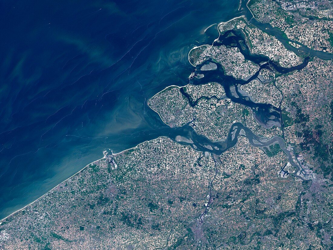
| Belgian-Dutch coast,satellite image. North is at top. The land across bottom is in Belgium,while the land at upper right is in the Netherlands. The water at upper left is part of the North Sea. The area seen here is around 135 kilometres across. Prominent features include the Belgian cities of Antwerp (grey/white,lower right),Ghent (grey,bottom centre),and Bruges (grey,lower left). Directly above Bruges,on the coast,is the large port of Zeebruge,with the harbour extending out from the coast. The major feature at upper right is the extensive delta where several major rivers (the Scheldt,bottom; and the Rhine and Meuse,top) reach the sea. Image obtained on 23 May 2001,by the ETM+ sensor on the Landsat 7 satellite | |
| Licence : | Droits gérés |
| Crédit: | Science Photo Library / NASA |
| Taille de l’image : | 4828 px × 3621 px |
| Model Release : | Non requis |
| Property Release : | Non requis |
| Restrictions : | - |
Prix pour cette image À partir de 45 €
Produit vendu
(Calendrier, Carte postale, Carte de vœux, Impression sur textile, Packaging etc)
À partir de 45 €
Usage commercial
(Affichage, Annonce presse, Annonce TV, Carte, Digital - hors rés. sociaux, Digital - rés. sociaux etc)
À partir de 45 €
Éditorial
(Digital, Journal, Livre, Livre pratique, Magazine, Télévision etc)
À partir de 60 €
Usage non-commercial
(Digital - hors rés. sociaux, Digital - rés. sociaux etc)
À partir de 120 €
Mots clés
- 21ème siècle,
- Anvers,
- appareil de cartographie thématique amélioré,
- belge,
- Belgique,
- BRUGES,
- côte,
- côtier,
- de l'espace,
- delta,
- eau,
- Enhanced Thematic Mapper Plus,
- environnement,
- ETM+,
- Europe,
- européen,
- Gand,
- géographie,
- géographique,
- Hollande,
- image satellite,
- landsat 7,
- littoral,
- Mer du Nord,
- néerlandais,
- observation de la terre,
- Pays-Bas,
- port,
- Rhin,
- rivière,
- rivières,
- satellite,
- terre,
- urbain,
- ville,
- villes,
- XX1ème siècle