Nile Delta,satellite image
Numéro d’image : 11745137
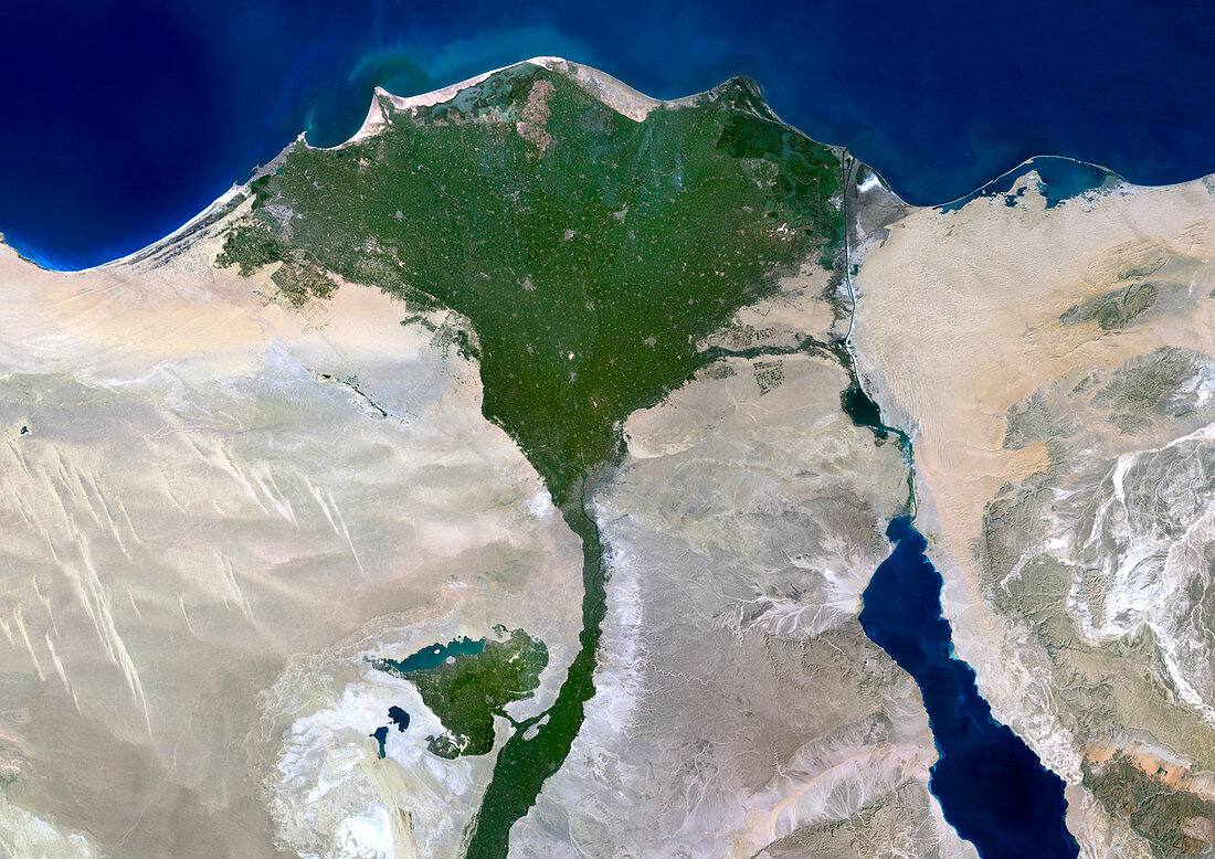
| Nile Delta,Egypt,satellite image. North is at top. The River Nile flows from bottom,out of the deserts (light brown) of Egypt,and into the Mediterranean Sea (top,blue). As it reaches the sea it slows down and deposits its load of sediment,forming this fan-shaped delta that is rich in vegetation (green). The delta is around 200 kilometres across. One of the northern ends of the Red Sea is at lower right,and the Suez Canal is at upper right. Image data obtained on 23 August 2000 | |
| Licence : | Droits gérés |
| Crédit: | Science Photo Library / Planetobserver |
| Taille de l’image : | 4961 px × 3508 px |
| Model Release : | Non requis |
| Property Release : | Non requis |
| Restrictions : | - |
Prix pour cette image À partir de 45 €
Produit vendu
(Calendrier, Carte postale, Carte de vœux, Impression sur textile, Packaging etc)
À partir de 45 €
Usage commercial
(Affichage, Annonce presse, Annonce TV, Carte, Digital - hors rés. sociaux, Digital - rés. sociaux etc)
À partir de 45 €
Éditorial
(Digital, Journal, Livre, Livre pratique, Magazine, Télévision etc)
À partir de 60 €
Usage non-commercial
(Digital - hors rés. sociaux, Digital - rés. sociaux etc)
À partir de 120 €
Mots clés
- 2000,
- 21ème siècle,
- africain,
- Afrique,
- Août,
- canal de Suez,
- de l'espace,
- delta,
- delta du Nil,
- Égypte,
- égyptien,
- égyptienne,
- environnement,
- été,
- géographie,
- géographie physique,
- géographique,
- image satellite,
- littoral,
- méditérranéen,
- Mer Rouge,
- nature,
- observation de la terre,
- rivière,
- satellite,
- science de la terre,
- XX1ème siècle