Mississippi Delta,satellite image
Numéro d’image : 11745136
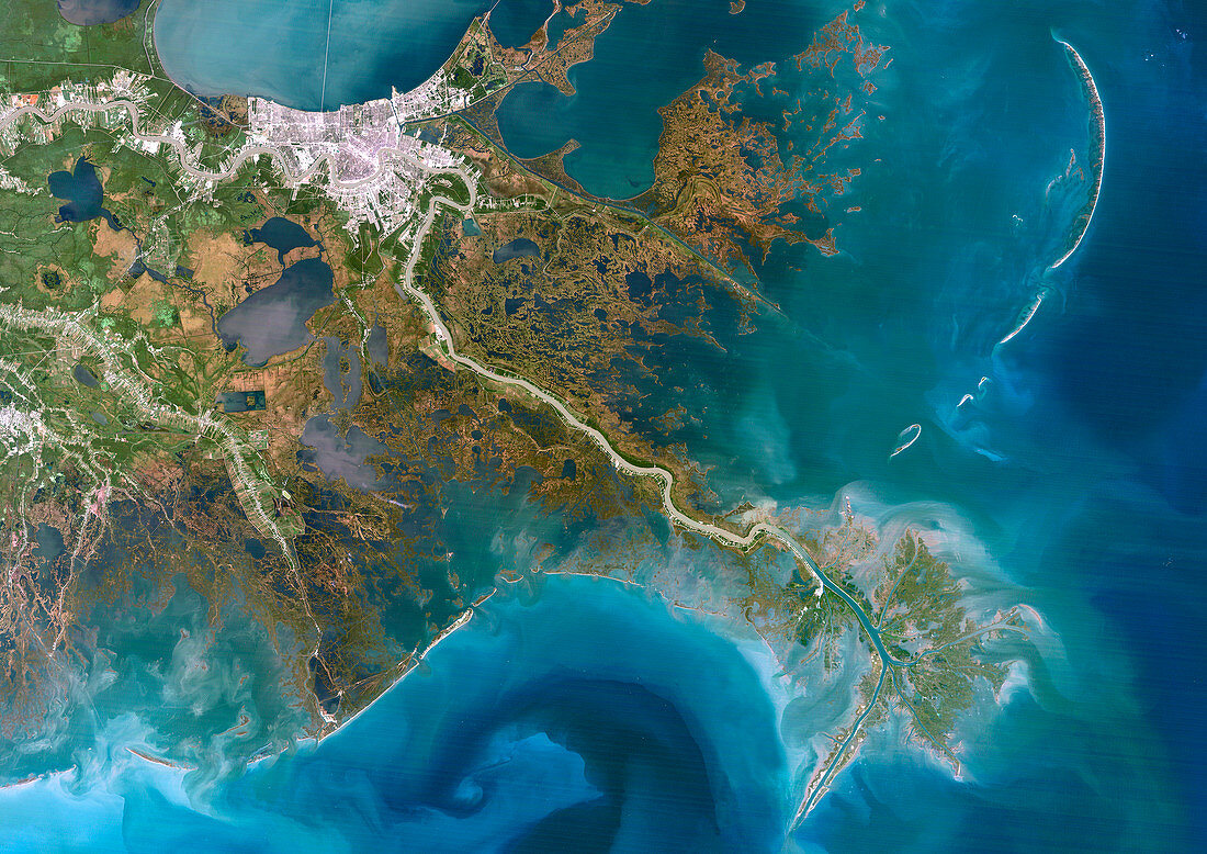
| Mississippi Delta,USA,satellite image. North is at top. The Mississippi River flows from top left through the city of New Orleans (white,upper left),and down to lower right,and out into the Gulf of Mexico. Much of the land in the image has been built up by sediments deposited by the river. The latest phase of delta formation can be seen at bottom right,and swirling patterns in the water and varying colours show the formation of sand banks and the presence of turbulent sediments. This area is around 200 kilometres across. Image data obtained on 12 October 1991 | |
| Licence : | Droits gérés |
| Crédit: | Science Photo Library / Planetobserver |
| Taille de l’image : | 4961 px × 3508 px |
| Model Release : | Non requis |
| Property Release : | Non requis |
| Restrictions : | - |
Prix pour cette image À partir de 45 €
Produit vendu
(Calendrier, Carte postale, Carte de vœux, Impression sur textile, Packaging etc)
À partir de 45 €
Usage commercial
(Affichage, Annonce presse, Annonce TV, Carte, Digital - hors rés. sociaux, Digital - rés. sociaux etc)
À partir de 45 €
Éditorial
(Digital, Journal, Livre, Livre pratique, Magazine, Télévision etc)
À partir de 60 €
Usage non-commercial
(Digital - hors rés. sociaux, Digital - rés. sociaux etc)
À partir de 120 €
Mots clés
- 1900,
- 1990,
- 1991,
- 20ème siècle,
- américain,
- Amérique du Nord,
- automne,
- de l'espace,
- delta,
- delta du Mississippi,
- environnement,
- Etats-Unis,
- géographie,
- géographie physique,
- géographique,
- Golfe du Mexique,
- image satellite,
- littoral,
- mer,
- N/A,
- nature,
- nord américain,
- nord-américain,
- Nouvelle Orléans,
- observation de la terre,
- océan,
- octobre,
- rivière,
- satellite,
- science de la terre,
- US,
- USA,
- ville,
- XXème siècle