Shatt al Arab river delta
Numéro d’image : 11745124
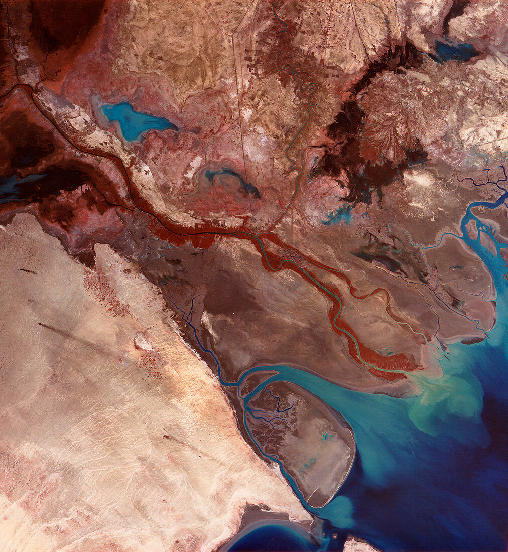
| Shatt al Arab river delta,Middle East,infrared satellite image. North is at top. This delta is formed where the Shatt al Arab River flows from upper left into the Persian Gulf (bottom right). The delta's land is formed by silt (light blue). The Shatt al Arab River is formed by the merging of the Euphrates and Tigris rivers. The land is divided between Kuwait (lower left),Iran (upper right) and Iraq (along river). This 180-kilometre- wide image was taken on 23 December 1972,in visible and infrared wavelengths,with the Multispectral Scanner (MSS) sensor on NASA's Landsat 1 satellite | |
| Licence : | Droits gérés |
| Crédit: | Science Photo Library / MDA Information Systems |
| Taille de l’image : | 4010 px × 4360 px |
| Model Release : | Non requis |
| Property Release : | Non requis |
| Restrictions : | - |
Prix pour cette image À partir de 45 €
Produit vendu
(Calendrier, Carte postale, Carte de vœux, Impression sur textile, Packaging etc)
À partir de 45 €
Usage commercial
(Affichage, Annonce presse, Annonce TV, Carte, Digital - hors rés. sociaux, Digital - rés. sociaux etc)
À partir de 45 €
Éditorial
(Digital, Journal, Livre, Livre pratique, Magazine, Télévision etc)
À partir de 60 €
Usage non-commercial
(Digital - hors rés. sociaux, Digital - rés. sociaux etc)
À partir de 120 €
Mots clés
- 1972,
- asiatique,
- Asie,
- boue,
- canadarm2,
- côte,
- côtier,
- de l'espace,
- décembre,
- delta,
- environnement,
- environnemental,
- estuaire,
- frontière,
- géographie,
- géographique,
- Golfe Persique,
- infrarouge,
- Irak,
- irakien,
- iran,
- iranien,
- Koweït,
- Landsat 1,
- Moyen Orient,
- Moyen-Orient,
- multispectral,
- observation de la terre,
- rivière,
- satellite,
- silt,
- système d'entretien mobile,
- un