Bombetoka Bay,Madagascar
Numéro d’image : 11745122
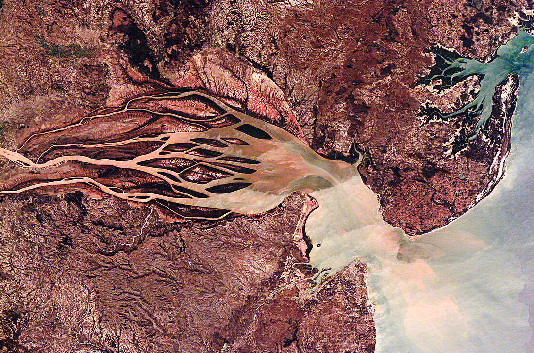
| Bombetoka Bay,Madagascar. This bay is formed from the estuary of the Betsiboka River,which flows from the island's interior into the Mozambique Channel. North is at lower right. The dark areas on the banks and estuarine islands are mangrove forests. The Betsiboka River carries an enormous amount of sediment,mainly due to the fact that the land surrounding the river has been deforested to make way for crops such as rice | |
| Licence : | Droits gérés |
| Crédit: | Science Photo Library / NASA |
| Taille de l’image : | 3060 px × 2024 px |
| Model Release : | Non requis |
| Property Release : | Non requis |
| Restrictions : | - |
Prix pour cette image À partir de 45 €
Produit vendu
(Calendrier, Carte postale, Carte de vœux, Impression sur textile, Packaging etc)
À partir de 45 €
Usage commercial
(Affichage, Annonce presse, Annonce TV, Carte, Digital - hors rés. sociaux, Digital - rés. sociaux etc)
À partir de 45 €
Éditorial
(Digital, Journal, Livre, Livre pratique, Magazine, Télévision etc)
À partir de 60 €
Usage non-commercial
(Digital - hors rés. sociaux, Digital - rés. sociaux etc)
À partir de 120 €