River Nile,satellite image
Numéro d’image : 11744963
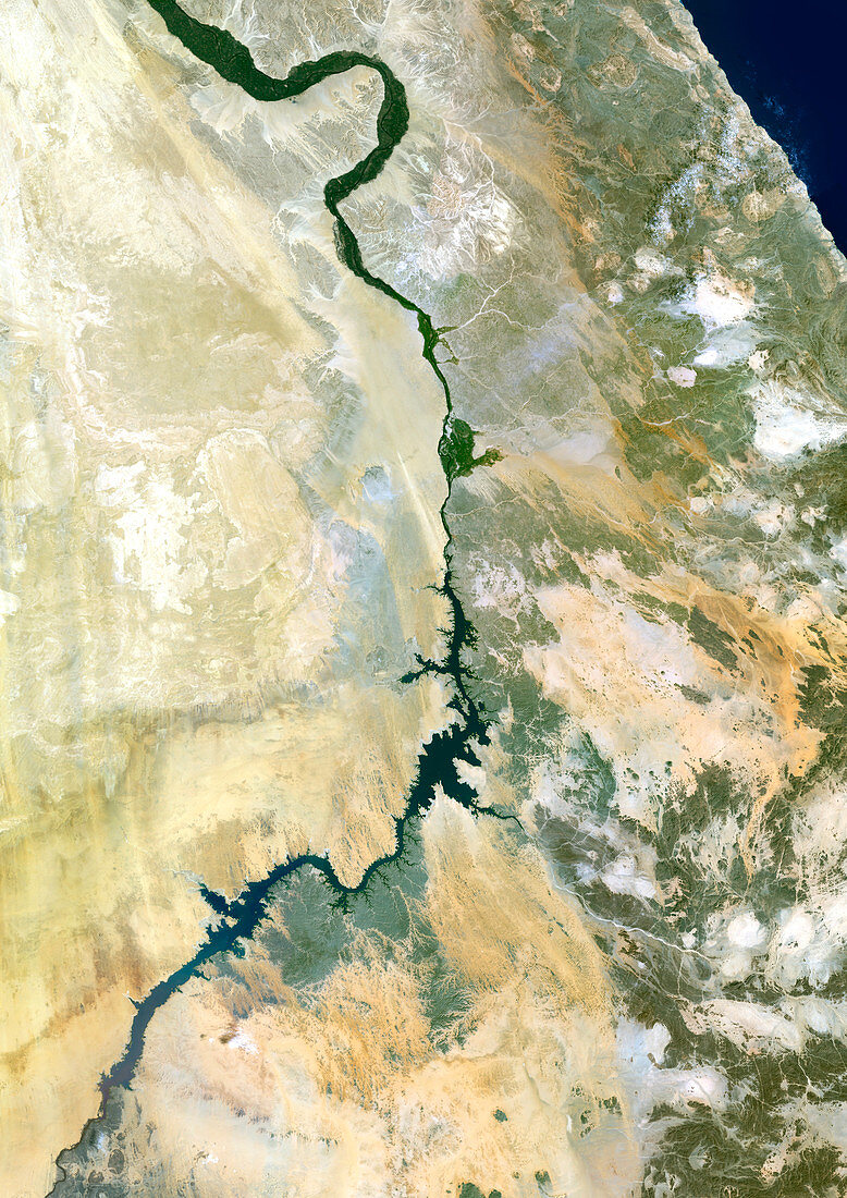
| River Nile,satellite image. North is at top. This is the southern section of the River Nile. Sudan is at bottom,Egypt is at top. The large meander at the top of the image marks the site of the ancient city of Luxor,whilst the wider stretch of water below centre is Lake Nasser,formed by the Aswan High Dam. This dam was constructed in the 1960s,retaining 80 billion cubic metres of water for irrigation and producing 8 billion kilowatts an hour from its hydroelectric plant. It does however allow the silt to settle,leading to fertility problems and bank erosion | |
| Licence : | Droits gérés |
| Crédit: | Science Photo Library / Planetobserver |
| Taille de l’image : | 3508 px × 4961 px |
| Model Release : | Non requis |
| Property Release : | Non requis |
| Restrictions : | - |
Prix pour cette image À partir de 45 €
Produit vendu
(Calendrier, Carte postale, Carte de vœux, Impression sur textile, Packaging etc)
À partir de 45 €
Usage commercial
(Affichage, Annonce presse, Annonce TV, Carte, Digital - hors rés. sociaux, Digital - rés. sociaux etc)
À partir de 45 €
Éditorial
(Digital, Journal, Livre, Livre pratique, Magazine, Télévision etc)
À partir de 60 €
Usage non-commercial
(Digital - hors rés. sociaux, Digital - rés. sociaux etc)
À partir de 120 €
Mots clés
- africain,
- Afrique,
- Afrique de l'Est,
- Afrique du Nord,
- de l'espace,
- désert,
- Égypte,
- égyptien,
- égyptienne,
- énergie hydroélectrique,
- environnement,
- environnemental,
- géographie,
- géographique,
- image satellite,
- lac,
- le Nil,
- Mer Rouge,
- Moyen Orient,
- Moyen-Orient,
- Nil,
- observation de la terre,
- pays,
- réservoir,
- rivière,
- satellite,
- Soudan