Amazon Basin river,satellite image
Numéro d’image : 11744961
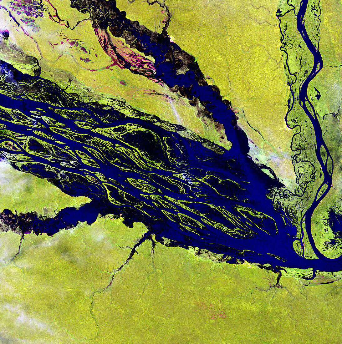
| Amazon Basin river,satellite image. North is at top. Water is blue/black,vegetation is green,and barren areas (upper left) are red. This is the Negro River in northern Brazil,the Amazon River's largest tributary. The mosaic of mid-stream islands disappears when rainy season storms raise the water level. The land surrounding the river is covered in dense tropical rainforest. The area shown in this image is around 60 kilometres wide. The image data was obtained on 31 August 2000,by the Landsat 7 satellite | |
| Licence : | Droits gérés |
| Crédit: | Science Photo Library / NASA |
| Taille de l’image : | 4800 px × 4832 px |
| Model Release : | Non requis |
| Property Release : | Non requis |
| Restrictions : | - |
Prix pour cette image À partir de 45 €
Produit vendu
(Calendrier, Carte postale, Carte de vœux, Impression sur textile, Packaging etc)
À partir de 45 €
Usage commercial
(Affichage, Annonce presse, Annonce TV, Carte, Digital - hors rés. sociaux, Digital - rés. sociaux etc)
À partir de 45 €
Éditorial
(Digital, Journal, Livre, Livre pratique, Magazine, Télévision etc)
À partir de 60 €
Usage non-commercial
(Digital - hors rés. sociaux, Digital - rés. sociaux etc)
À partir de 120 €
Mots clés
- 2000,
- 21ème siècle,
- amazonien,
- Amérique du Sud,
- Août,
- bassin de l'Amazone,
- Brésil,
- brésilien,
- de l'espace,
- eau,
- environnement,
- fluvial,
- forêt,
- forêt tropicale,
- géographie,
- géographie physique,
- géographique,
- hydrologie,
- image satellite,
- jungle,
- landsat 7,
- nature,
- observation de la terre,
- riverain,
- rivière,
- satellite,
- science de la terre,
- Sud Américain,
- Sud-Américain,
- terre,
- tropical,
- tropiques,
- végétation,
- XX1ème siècle