Niagara River,US-Canada border
Numéro d’image : 11744926
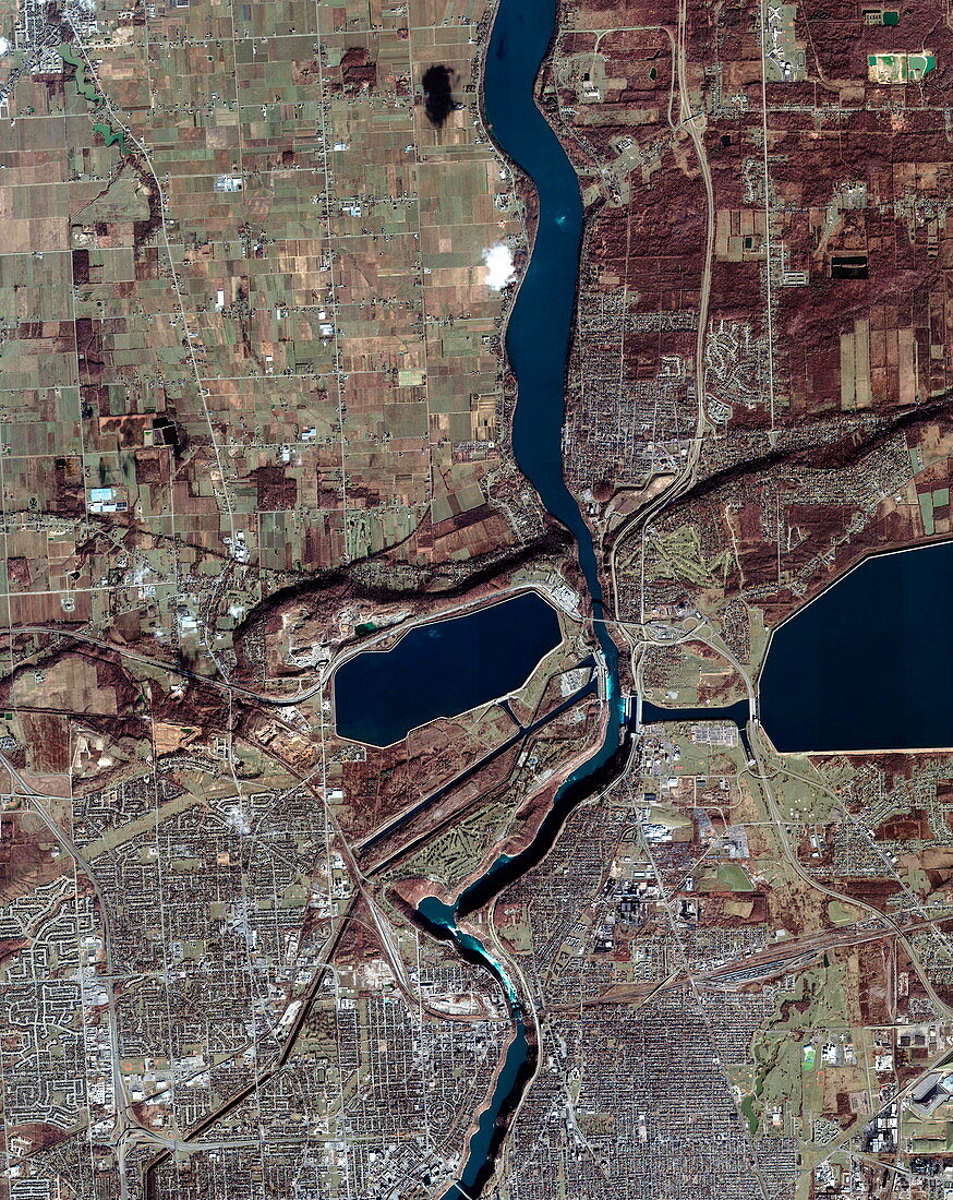
| Niagara River. Satellite image of Niagara River (down centre) on the US-Canada border. North is at top. Canadian land is at left,while US land is at right. This short river flows from south to north,draining Lake Erie into Lake Ontario. This part of the river is just north of Niagara Falls (not seen here). Some of the water is diverted from above the falls to form two reservoirs: Ontario Hydro Reservoir (centre) and Power Reservoir (far right). The area of white foam between the two is where falling water is being used to generate electricity. The town of Niagara Falls is across bottom. Agricultural fields are at upper left. Image taken by the Ikonos satellite on 10 December 2001 | |
| Licence : | Droits gérés |
| Crédit: | Science Photo Library / Geoeye |
| Taille de l’image : | 2936 px × 3696 px |
| Model Release : | Non requis |
| Property Release : | Non requis |
| Restrictions : | - |
Prix pour cette image À partir de 45 €
Produit vendu
(Calendrier, Carte postale, Carte de vœux, Impression sur textile, Packaging etc)
À partir de 45 €
Usage commercial
(Affichage, Annonce presse, Annonce TV, Carte, Digital - hors rés. sociaux, Digital - rés. sociaux etc)
À partir de 45 €
Éditorial
(Digital, Journal, Livre, Livre pratique, Magazine, Télévision etc)
À partir de 60 €
Usage non-commercial
(Digital - hors rés. sociaux, Digital - rés. sociaux etc)
À partir de 120 €
Mots clés
- 21ème siècle,
- américain,
- Amérique du Nord,
- Canada,
- canadien,
- chutes du Niagara,
- de l'espace,
- eau,
- électricité,
- énergie,
- environnement,
- environnemental,
- Etats-Unis,
- fleuve Niagara,
- frontière,
- géographie,
- géographique,
- hydroélectrique,
- Ikonos,
- image satellite,
- lac,
- lacs,
- N/A,
- nature,
- observation de la terre,
- puissance,
- réservoir,
- réservoirs,
- rivière,
- rivière Niagara,
- satellite,
- urbain,
- US,
- USA,
- ville,
- XX1ème siècle