Victoria Falls gorge
Numéro d’image : 11744807
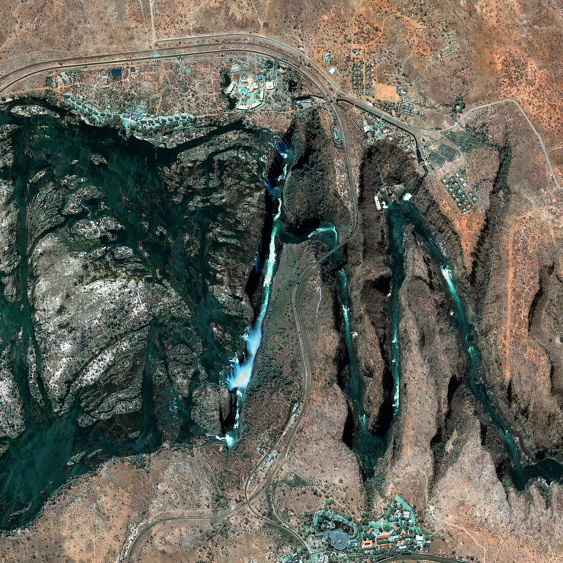
| Victoria Falls gorge. Satellite image of the gorge carved by the Victoria Falls. These falls (seen at centre left,white foam) are on the border between Zimbabwe and Zambia. The waterfall is formed as the Zambezi River falls into a 100-metre deep chasm. This chasm is a crack in the rock that was widened by the river. The zig-zag of chasms at right are where the waterfall used to be before it eroded a new chasm in the rock. The waterfall is slowly moving to the left as it erodes successive chasms in the rock. The Zambezi River is seen at left. Image taken by the Ikonos satellite on 11 September 2003 | |
| Licence : | Droits gérés |
| Crédit: | Science Photo Library / Geoeye |
| Taille de l’image : | 3000 px × 3000 px |
| Model Release : | Non requis |
| Property Release : | Non requis |
| Restrictions : | - |
Prix pour cette image À partir de 45 €
Produit vendu
(Calendrier, Carte postale, Carte de vœux, Impression sur textile, Packaging etc)
À partir de 45 €
Usage commercial
(Affichage, Annonce presse, Annonce TV, Carte, Digital - hors rés. sociaux, Digital - rés. sociaux etc)
À partir de 45 €
Éditorial
(Digital, Journal, Livre, Livre pratique, Magazine, Télévision etc)
À partir de 60 €
Usage non-commercial
(Digital - hors rés. sociaux, Digital - rés. sociaux etc)
À partir de 120 €
Mots clés
- 21ème siècle,
- africain,
- Afrique,
- canyon,
- canyons,
- cascade,
- chutes victoria,
- de l'espace,
- érodé,
- érosion,
- fleuve Zambèze,
- géographie,
- géographique,
- géologie,
- géologique,
- gorge,
- GORGES,
- Ikonos,
- image satellite,
- Mosi-Oa-Tunya,
- nature,
- observation de la terre,
- rivière,
- rivière Zambèse,
- roche,
- rocheux,
- satellite,
- XX1ème siècle,
- Zambèze,
- Zambie,
- Zimbabwé,
- zimbabwéen