Satellite view of Appalachian fold mountains
Numéro d’image : 11744639
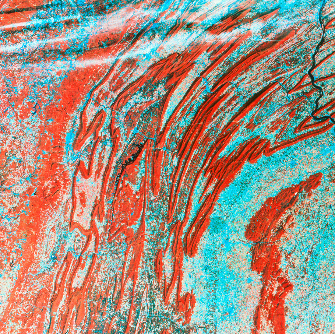
| Appalachian mountain folding. Coloured satellite image showing complex bands of folding in the Appalachian Mountains,north-east USA. The deep red colour of the folds indicates dense forest vegetation,whilst the pale blue in much of the rest of the frame denotes mixed agricultural land. The Appalachian range was formed by the folding of sedimentary rocks in the Palaeozoic Era about 400- 500 million years ago. Subsequent differential erosion of the various sediments present has emphasised the topography of the Appalachians. The data for this image were gathered by a Landsat satellite | |
| Licence : | Droits gérés |
| Crédit: | Science Photo Library / MDA Information Systems |
| Taille de l’image : | 3543 px × 3532 px |
| Model Release : | Non requis |
| Property Release : | Non requis |
| Restrictions : | - |
Prix pour cette image À partir de 45 €
Produit vendu
(Calendrier, Carte postale, Carte de vœux, Impression sur textile, Packaging etc)
À partir de 45 €
Usage commercial
(Affichage, Annonce presse, Annonce TV, Carte, Digital - hors rés. sociaux, Digital - rés. sociaux etc)
À partir de 45 €
Éditorial
(Digital, Journal, Livre, Livre pratique, Magazine, Télévision etc)
À partir de 60 €
Usage non-commercial
(Digital - hors rés. sociaux, Digital - rés. sociaux etc)
À partir de 120 €