Santorini volcano,satellite image
Numéro d’image : 11740785
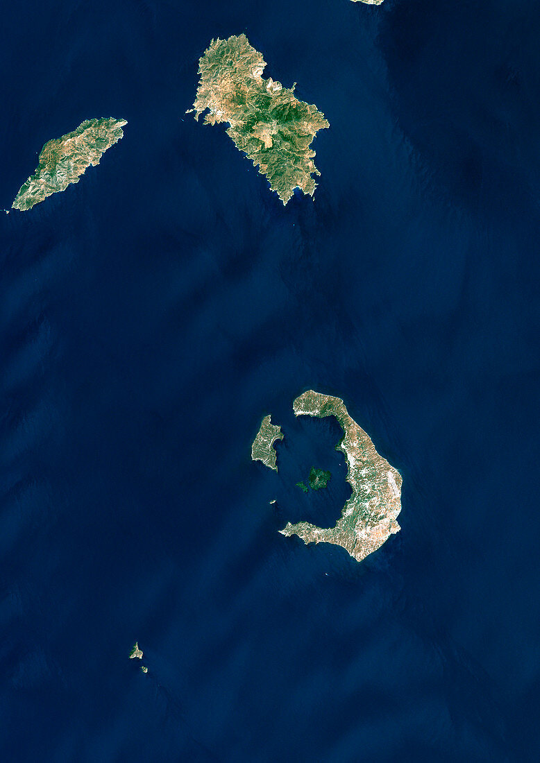
| Santorini volcano,Greece,satellite image. North is at top. The sea-filled caldera (lower right) shows where a massive volcanic eruption some 3500 years ago destroyed most of the island of Santorini (also called Thera). The island is part of the Cyclades archipelago,south-east of the Greek mainland. The caldera is about 12 kilometres long. Image data obtained on 8 August 1999 | |
| Licence : | Droits gérés |
| Crédit: | Science Photo Library / Planetobserver |
| Taille de l’image : | 3508 px × 4962 px |
| Model Release : | Non requis |
| Property Release : | Non requis |
| Restrictions : | - |
Prix pour cette image À partir de 45 €
Produit vendu
(Calendrier, Carte postale, Carte de vœux, Impression sur textile, Packaging etc)
À partir de 45 €
Usage commercial
(Affichage, Annonce presse, Annonce TV, Carte, Digital - hors rés. sociaux, Digital - rés. sociaux etc)
À partir de 45 €
Éditorial
(Digital, Journal, Livre, Livre pratique, Magazine, Télévision etc)
À partir de 60 €
Usage non-commercial
(Digital - hors rés. sociaux, Digital - rés. sociaux etc)
À partir de 120 €
Mots clés
- 1900,
- 1990,
- 1999,
- 20ème siècle,
- Août,
- caldera,
- cratère volcanique,
- de l'espace,
- effondré,
- environnement,
- été,
- Europe,
- européen,
- géographie,
- géographie physique,
- géographique,
- géologie,
- géologique,
- grec,
- Grèce,
- île,
- image satellite,
- inondé,
- nature,
- observation de la terre,
- satellite,
- science de la terre,
- super volcan,
- THERA,
- volcan,
- volcanique,
- vulcanologie,
- XXème siècle