Mount St Helens
Numéro d’image : 11740746
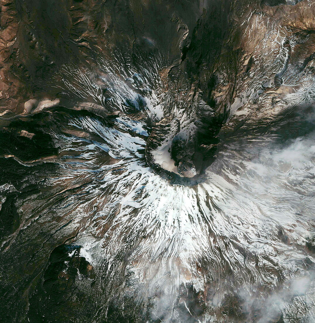
| Mount St Helens. Satellite image of Mount St Helens (MSH),Washington,USA. This prominent volcano is found in the Cascade Range,which stretches from British Columbia,Canada to Northern California,USA. MSH erupted on 18 May 1980,causing the upper 400 metres of the mountain to collapse,leaving behind a crater. MSH became active again after September 2004 and a new lava dome has been observed within the crater (brown circle,centre right). Image taken by the Ikonos satellite on 9 March 2005 | |
| Licence : | Droits gérés |
| Crédit: | Science Photo Library / Geoeye |
| Taille de l’image : | 2500 px × 2558 px |
| Model Release : | Non requis |
| Property Release : | Non requis |
| Restrictions : | - |
Prix pour cette image À partir de 45 €
Produit vendu
(Calendrier, Carte postale, Carte de vœux, Impression sur textile, Packaging etc)
À partir de 45 €
Usage commercial
(Affichage, Annonce presse, Annonce TV, Carte, Digital - hors rés. sociaux, Digital - rés. sociaux etc)
À partir de 45 €
Éditorial
(Digital, Journal, Livre, Livre pratique, Magazine, Télévision etc)
À partir de 60 €
Usage non-commercial
(Digital - hors rés. sociaux, Digital - rés. sociaux etc)
À partir de 120 €