Mount St Helens volcano
Numéro d’image : 11740741
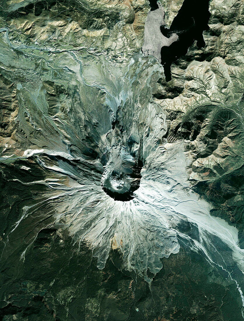
| Mount St Helens volcano,USA,satellite image. Mount St Helens is located in the south west of Washington State. This image was taken on the day the crater floor was deformed by a large uplift. The result of seismic activity in the previous fortnight. Its most devastating eruption was in 1980,when 57 people were killed and a huge area of forest around the volcano was levelled. The 1980 eruption blew the top off the mountain,reducing its height from 2950 metres to 2550 metres. Taken by the Ikonos satellite on 4 October 2004 | |
| Licence : | Droits gérés |
| Crédit: | Science Photo Library / Geoeye |
| Taille de l’image : | 3275 px × 4314 px |
| Model Release : | Non requis |
| Property Release : | Non requis |
| Restrictions : | - |
Prix pour cette image À partir de 45 €
Produit vendu
(Calendrier, Carte postale, Carte de vœux, Impression sur textile, Packaging etc)
À partir de 45 €
Usage commercial
(Affichage, Annonce presse, Annonce TV, Carte, Digital - hors rés. sociaux, Digital - rés. sociaux etc)
À partir de 45 €
Éditorial
(Digital, Journal, Livre, Livre pratique, Magazine, Télévision etc)
À partir de 60 €
Usage non-commercial
(Digital - hors rés. sociaux, Digital - rés. sociaux etc)
À partir de 120 €